• Home
  • About Us
    • Governance
      • About the LTVCA
      • Board of Directors
      • Board Meetings
      • Budget & Financial Statements
      • Public Consultation & Bids
      • Reports/ Plans/ Fees / MOUs
    • Get Involved
      • Employment
      • Volunteers
      • FAQ’s
      • What’s New?
  • Visit
    • Get Outside
      • Conservation Areas
      • Camping
      • Parking Passes
      • Healthy Hikes
    • Things to Do
      • Events
      • Ska-Nah-Doht Village & Museum
  • Conservation
    • Water Management
      • Flood Forecasting & Warning
      • LTVCA’s Flood Control Program
      • Water Control Structures
      • The History of Flooding
      • Flood Notices
      • Flood Notice Types
      • Water Levels
    • Conservation Services
      • Tree Planting
      • Grants for Landowners
      • Feature Partnership & Restoration Projects
      • Phosphorus Education
      • Funding for Farmers
      • Species at Risk
      • Invasive Species
      • Pollinator Habitats
      • Livestock Health
      • LIVING LAB – ONTARIO
  • Learning
    • Education Programs
      • School & Community Groups
      • On-the-Road Programs
      • Asynchronous Opportunities
      • Habitat Fact Resources
  • Planning & Regulations
    • Planning and Regs
      • Plan Input & Review
      • Regulations
      • Enforcement & Compliance
      • Regulated Areas Map
  • Contact Us
    • Get In Touch
      • Contact Form
      • Enforcement & Compliance
      • Staff Directory

Call us 519-354-7310

[email protected]
Lower Thames Valley Conservation AuthorityLower Thames Valley Conservation Authority
  • Home
  • About Us
    • Governance
      • About the LTVCA
      • Board of Directors
      • Board Meetings
      • Budget & Financial Statements
      • Public Consultation & Bids
      • Reports/ Plans/ Fees / MOUs
    • Get Involved
      • Employment
      • Volunteers
      • FAQ’s
      • What’s New?
  • Visit
    • Get Outside
      • Conservation Areas
      • Camping
      • Parking Passes
      • Healthy Hikes
    • Things to Do
      • Events
      • Ska-Nah-Doht Village & Museum
  • Conservation
    • Water Management
      • Flood Forecasting & Warning
      • LTVCA’s Flood Control Program
      • Water Control Structures
      • The History of Flooding
      • Flood Notices
      • Flood Notice Types
      • Water Levels
    • Conservation Services
      • Tree Planting
      • Grants for Landowners
      • Feature Partnership & Restoration Projects
      • Phosphorus Education
      • Funding for Farmers
      • Species at Risk
      • Invasive Species
      • Pollinator Habitats
      • Livestock Health
      • LIVING LAB – ONTARIO
  • Learning
    • Education Programs
      • School & Community Groups
      • On-the-Road Programs
      • Asynchronous Opportunities
      • Habitat Fact Resources
  • Planning & Regulations
    • Planning and Regs
      • Plan Input & Review
      • Regulations
      • Enforcement & Compliance
      • Regulated Areas Map
  • Contact Us
    • Get In Touch
      • Contact Form
      • Enforcement & Compliance
      • Staff Directory

Flood Warning – February 7, 2019 – 4:45 p.m.

Home » Flood Warning – February 7, 2019 – 4:45 p.m.
Flood Warning – February 7, 2019 – 4:45 p.m.

Flood Warning – February 7, 2019 – 4:45 p.m.

February 7, 2019

Highlights:

• Ice jam remains in place downstream of Chatham around Prairie Siding
• Water levels are still rising in the city of Chatham and will likely continue to do so overnight.
• Flooded basements along King St. and water on Siskind Court
• Expect flooding on William St., Water St., Salter St., and Thames Street overnight.
• Flooding as a result of ice jamming can be very unpredictable.

Message:

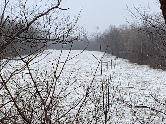
Last night an ice jam formed downstream of the city of Chatham around Prairie Siding. It caused water levels in the city to rise rapidly through the night and have continued to rise all day.

The behavior of ice jam related flooding is very unpredictable. Based on current rates of water level rise in the city and historical events, it is anticipated that there could be an additional 75 cm rise before the river peaks, which might occur by tomorrow morning. There is already basement flooding along King St. and there is water on Siskind Court. Most of the streets that flooded during last year’s flood event are also expected to flood for this event. This would include, but not be limited to, William St at Water St., Salter St., and Thames Street. Flooding on most of these streets should be expected this evening or overnight.

Should conditions of the ice jam itself change, there could be additional impacts along the downstream portions of the river through the Raleigh and Dover areas and into the town of Lakeshore including Lighthouse Cover. Residents should pay close attention to local conditions and be prepared should water levels exceed the flood protections.

The LTVCA continues to operating the 6th Street Dam and Pumping Station. This should protect the south end of the city of Chatham on McGregor Creek from flooding. However, residents in the south end of the city of Chatham should also pay attention to local conditions. A system of thunderstorms is moving through the area, mostly south of us. As water levels are high, excessive rainfall could lead to localized flooding upstream in the areas along McGregor and Indian Creek currently protected by the 6th Street Dam.

People should take extra caution and avoid the river, ditches, and streams. The combination of slippery banks, broken or unstable ice and fast moving cold water can be dangerous. Standing water can also present its own unseen hazards. Children and pets and livestock should be kept away from the water.

Officials will continue to monitor the situation and update this advisory if necessary.

This message will be in effect until February 10th, 2019.

Contact: LTVCA Administration Office (519-354-7310) regarding this message. After hours number 519-351-2240.

Share

What’s New?

  • Watershed Condition Statement – Safety Bulletin – Thames River – April 7, 2025 – 12:00 PM
  • Flood Watch – Thames River and smaller watercourses – April 6, 2025 – 1:00 PM
  • Flood Watch – Thames River and smaller watercourses – April 5, 2025 – 9:00 AM
  • Flood Watch – Thames River and smaller watercourses – April 3, 2025 – 3:00 PM
  • Watershed Condition Statement – Flood Outlook – Smaller watercourses and Thames River – April 1, 2025 – 2:00 PM

Facebook

What’s New?

  • Breakfast & BMPs – Register Today!
  • NEW! Funding for Farmers – 2025 Guide and Application Form
  • Create Something this March Break
  • Battle of Longwoods Returns to Longwoods Road Conservation Area
  • Birding at Big ‘O’

Partner Links

  • Lower Thames Valley Conservation Foundation
  • Conservation Ontario
  • Thames Heritage River; Canadian Heritage Rivers System
  • Chatham-Kent and Lambton Children’s Water Festival
  • Thames-Sydenham & Region Source Protection Area
  • Thames River Clear Water Revival

Connect with us!

Search

© 2025 · Lower Thames Valley Conservation Authority |[email protected] | Tel: 519-354-7310

  • Home
  • Privacy
  • Public Social Media Policy
  • Contact Form
Prev Next