The LTVCA, with the support of local land owners, has been undertaking a Phosphorus Reduction Program for McGregor and Jeannettes Creek Phosphorus Reduction Program. The purpose of the project, which began in 2021, is to improve soil health and reduce the amount of agriculturally sourced phosphorus entering the Thames River, Lake St. Clair and ultimately the Western Basin of Lake Erie.
Reductions achieved through the implementation of best management practices are quantified through subwatershed monitoring and modeling activities to assist Ontario and Canada with meeting the Thames River 40% reduction target for total and soluble reactive phosphorus loads entering Lake St. Clair and Lake Erie. The goal of the target is to reduce the severity and development of green and blue algae blooms in the Lake Erie Basin.
Incorporating Green Infrastructure into Municipal Drainage Systems
 In collaboration with the Municipal Drainage Services departments within the Lower Thames Watershed, staff from the Lower Thames Valley Conservation Authority (LTVCA) have been working to incorporate Green Infrastructure into municipal drainage systems.
Green infrastructure helps to reduce runoff and improve issues of water quantity and quality. Some examples of Green Infrastructure include two-stage channels, wetlands, grassed waterways, riparian buffers and naturalizing the dykes and channel.
Funding provided through a grant from OMAFRA-COA has allowed staff the opportunity to identified and targeted municipal drains that are experiencing significant embankment slumping, erosion, and channel scouring that could benefit from the incorporation of green infrastructure.
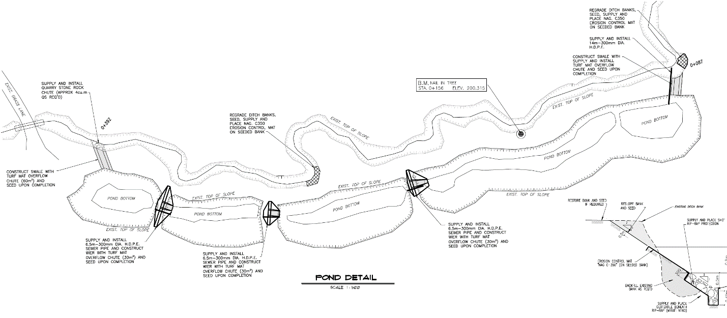
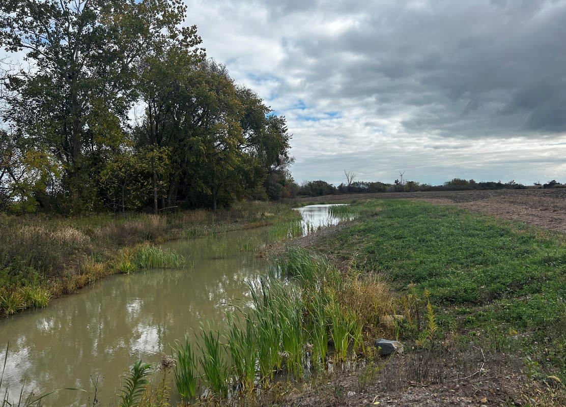 One completed Green Infrastructure project includes the McKinley Project that is located near Rondeau, Ontario. The landowner expressed concerns about erosion occurring along the drain at different locations. The Crawford municipal drain located on the property has a drainage area of 1161 acres of rolling farmland.
Recent upgrades to enhance the drains capacity include the incorporation of erosion control features such as wetlands and berms. These structures utilize the natural environment and engineered systems to manage water. The small earthen dams hold water on the land and then releasing it slowly through drainage system. The McKinley project is a great example of Green Infrastructure being used in a rural context to address rising concerns about water quantity on farmland.
This project is funded by the Ontario Ministry of Agriculture, Food and Rural Affairs (OMAFRA). The LTVCA’s partners on this project include the Ontario Ministry of Agriculture and Rural Affairs, The Chatham Kent Drainage Department, Spriet Associates Engineers and Architects, and Robert J Spence Construction. The current funding agreement for the program concludes during March of 2024.
Soil Health Assessment Plan
The Lower Thames Valley Conservation Authority (LTVCA) partnered with The Soil Resource Group Limited (SRG) to provide the Soil Health Assessment Plan (SHAP) program to farm businesses within the LTVCA watershed. The SHAP program involved collaborating with farmers to address their soil health concerns and to provide tailored soil sampling, reports, and recommendations for their soil degradation challenges.
Promotion of the SHAP program was conducted through advertisements from pre-existing contact lists, public radio ads, and during conversation with farmers. This program’s publicity was targeted towards farmer and farm operators, highlighting free soil sampling on 1-2 fields and receiving recommendation for soil health improvement from an agronomist and soil health expert.
Following interest inquiries, the farmers’ general information was collected, including the farmers’ soil concerns, the field locations, previous crop and soil type. A two-part assessment was planned, including an in-field soil survey and a soil management survey. The in-field survey date was provided closer to the sampling date to ensure the farmer’s acknowledgement.
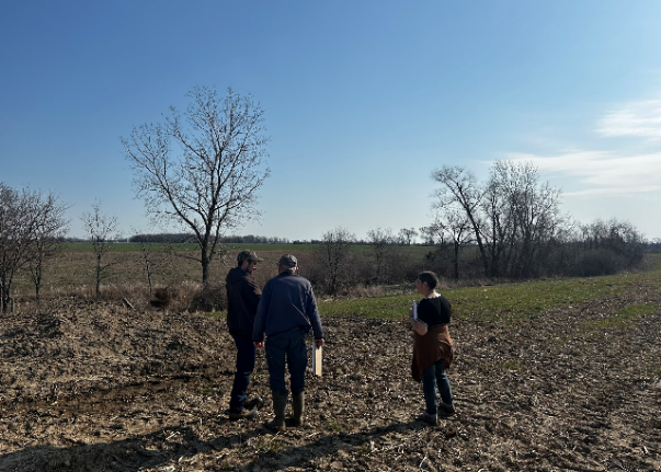
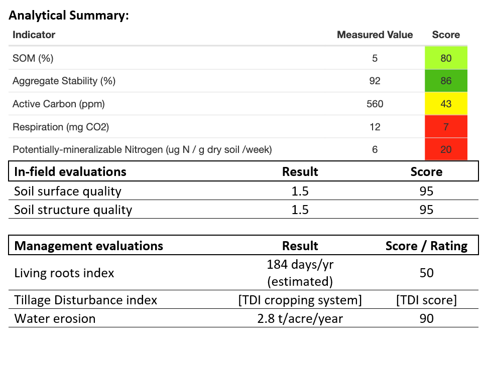
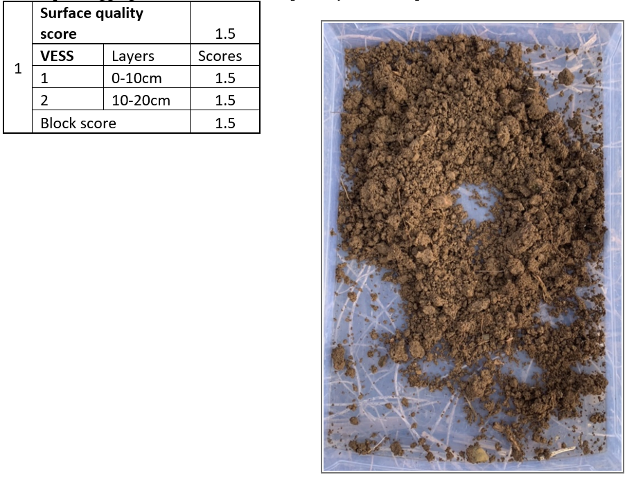 LTVCA Agriculture Stewardship staff and the SRG’s soil expert conducted in-field soil surveys using visual and specially designed sampling methodology. To begin, a visual assessment focusing on signs of compaction, water erosion, and crop residue distribution was conducted to evaluate the field’s dynamics and to select a representative spots to sample. Once a suitable spot was selected, soil characteristics including soil type, texture, structure (aggregates), surface quality (crusting), and layer thickness was determined. These characteristics reflect the field’s soil quality and soil health challenges. For instance, less crusting with high earthworm activity allows for more water infiltration, and stronger emergence, thus would be rated better than a heavy crusting soil. Each soil characteristic is assigned a score to reflect their health level, where a low score suggests possible limiting factors to soil health and productivity. Additionally, 15-centimeter core samples were taken from the sampling locations, mix, packaged, and sent to the University of Guelph Agriculture and Food Laboratory for testing. The laboratory testing included basic fertility parameters, organic matter, soil respiration, and other soil health indicators to help base recommendations.
Soil management surveys were conducted with farmers to gain more insight to their practices, so that tailored recommendations could be made. These soil management survey contained information on their basic rotation, tillage, and BMP practices applied to the field of study. Additional modules including tillage disturbance, living roots, water erosion risk, and compaction risk were offered depending on the soil health concerns. These modules provide a more in-depth assessment so that personalized recommendations could be made.
 A full report depicting the in-field and module risk results was provided and discussed with the farmer, including short, medium, and long-term management actions to help improve their soil health. Recommendation examples included adding cover crops and soil amendments, and reducing tillage to increase the field’s organic matter. A question and answer period from the farmer to the staff followed the report, and included questions such as implementation ideas, previous experience, and current trials. The SHAP project allowed for a positive interaction between parties and enabled the farmer to receive a field baseline with results and recommendations to improve their soil health challenges.
![]() This project is funded by the Ontario Ministry of Agriculture, Food and Rural Affairs (OMAFRA). Delivery of the project was made with support from The Soil Resource Group. The current funding agreement for the program concludes during March of 2024.
This project is funded by the Ontario Ministry of Agriculture, Food and Rural Affairs (OMAFRA). Delivery of the project was made with support from The Soil Resource Group. The current funding agreement for the program concludes during March of 2024.