Watershed Conditions – Safety Bulletin
Date: 12:30 P.M., Thursday, March 19, 2015
Issued to: Municipal Flood Coordinators of Municipalities, Media
Issued by: Lower Thames Valley Conservation Authority
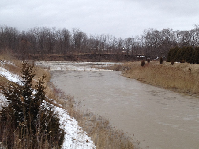
Warming temperatures over the last two weeks caused most of the snowpack in the lower Thames watershed to melt and run off into the region’s watercourses. Some of the region`s smaller watercourses had reached bank full conditions or even topped their banks. Water levels on these smaller watercourses have now dropped and areas of localized flooding are drying out.
Water levels on the lower Thames River upstream of Chatham-Kent are also dropping. However, ice jamming through the stretch upstream of Chatham to the Thamesville area has caused water levels to rise and flood the low lying areas adjacent to the river. Water levels can be expected to remain high through this stretch until the ice jams release or until flows from upstream drop enough. Water levels in Chatham can be expected to rise some more as the backed up water makes it way downstream. Water levels are not expected to rise enough to flood the upper tablelands. Downstream of Chatham the Thames River is open almost all the way to Prairie Siding. Flows are not anticipated to reach levels that have historically caused ice jam related flooding in Lighthouse Cove.
People should take extra caution and avoid the river, lakes, ditches, streams, and ponds. The combination of slippery banks, moving/melting ice and cold water is particularly dangerous. Parents should pay special attention to keep their children away from the water during this March Break.
The Lower Thames Valley Conservation Authority will continue to monitor conditions and will issue additional messages as required.
Contact: Jason Wintermute (519-354-7310 x227 or this email address) regarding this message.
This message will be in effect until March 23rd unless revised.