• Home
  • About Us
    • Governance
      • About the LTVCA
      • Board of Directors
      • Board Meetings
      • Budget & Financial Statements
      • Public Consultation & Bids
      • Reports/ Plans/ Fees / MOUs
    • Get Involved
      • Employment
      • Volunteers
      • FAQ’s
      • What’s New?
  • Visit
    • Get Outside
      • Conservation Areas
      • Camping
      • Parking Passes
      • Healthy Hikes
    • Things to Do
      • Events
      • Ska-Nah-Doht Village & Museum
  • Conservation
    • Water Management
      • Flood Forecasting & Warning
      • LTVCA’s Flood Control Program
      • Water Control Structures
      • The History of Flooding
      • Flood Notices
      • Flood Notice Types
      • Water Levels
    • Conservation Services
      • Tree Planting
      • Grants for Landowners
      • Feature Partnership & Restoration Projects
      • Phosphorus Education
      • Funding for Farmers
      • Species at Risk
      • Invasive Species
      • Pollinator Habitats
      • Livestock Health
      • LIVING LAB – ONTARIO
  • Learning
    • Education Programs
      • School & Community Groups
      • On-the-Road Programs
      • Asynchronous Opportunities
      • Habitat Fact Resources
  • Planning & Regulations
    • Planning and Regs
      • Plan Input & Review
      • Regulations
      • Enforcement & Compliance
      • Regulated Areas Map
  • Contact Us
    • Get In Touch
      • Contact Form
      • Enforcement & Compliance
      • Staff Directory

Call us 519-354-7310

[email protected]
Lower Thames Valley Conservation AuthorityLower Thames Valley Conservation Authority
  • Home
  • About Us
    • Governance
      • About the LTVCA
      • Board of Directors
      • Board Meetings
      • Budget & Financial Statements
      • Public Consultation & Bids
      • Reports/ Plans/ Fees / MOUs
    • Get Involved
      • Employment
      • Volunteers
      • FAQ’s
      • What’s New?
  • Visit
    • Get Outside
      • Conservation Areas
      • Camping
      • Parking Passes
      • Healthy Hikes
    • Things to Do
      • Events
      • Ska-Nah-Doht Village & Museum
  • Conservation
    • Water Management
      • Flood Forecasting & Warning
      • LTVCA’s Flood Control Program
      • Water Control Structures
      • The History of Flooding
      • Flood Notices
      • Flood Notice Types
      • Water Levels
    • Conservation Services
      • Tree Planting
      • Grants for Landowners
      • Feature Partnership & Restoration Projects
      • Phosphorus Education
      • Funding for Farmers
      • Species at Risk
      • Invasive Species
      • Pollinator Habitats
      • Livestock Health
      • LIVING LAB – ONTARIO
  • Learning
    • Education Programs
      • School & Community Groups
      • On-the-Road Programs
      • Asynchronous Opportunities
      • Habitat Fact Resources
  • Planning & Regulations
    • Planning and Regs
      • Plan Input & Review
      • Regulations
      • Enforcement & Compliance
      • Regulated Areas Map
  • Contact Us
    • Get In Touch
      • Contact Form
      • Enforcement & Compliance
      • Staff Directory

Watershed Conditions – Safety Bulletin – Lake Erie Shoreline – Erie Shore Drive and Rondeau – 9:15 AM – May 23, 2019

Home » Watershed Conditions – Safety Bulletin – Lake Erie Shoreline – Erie Shore Drive and Rondeau – 9:15 AM – May 23, 2019
Watershed Conditions – Safety Bulletin – Lake Erie Shoreline – Erie Shore Drive and Rondeau – 9:15 AM – May 23, 2019

Watershed Conditions – Safety Bulletin – Lake Erie Shoreline – Erie Shore Drive and Rondeau – 9:15 AM – May 23, 2019

May 23, 2019

Highlights:

–     Environment Canada has issued a Strong Wind Warning as well as a Squall Warning for Lake Erie.
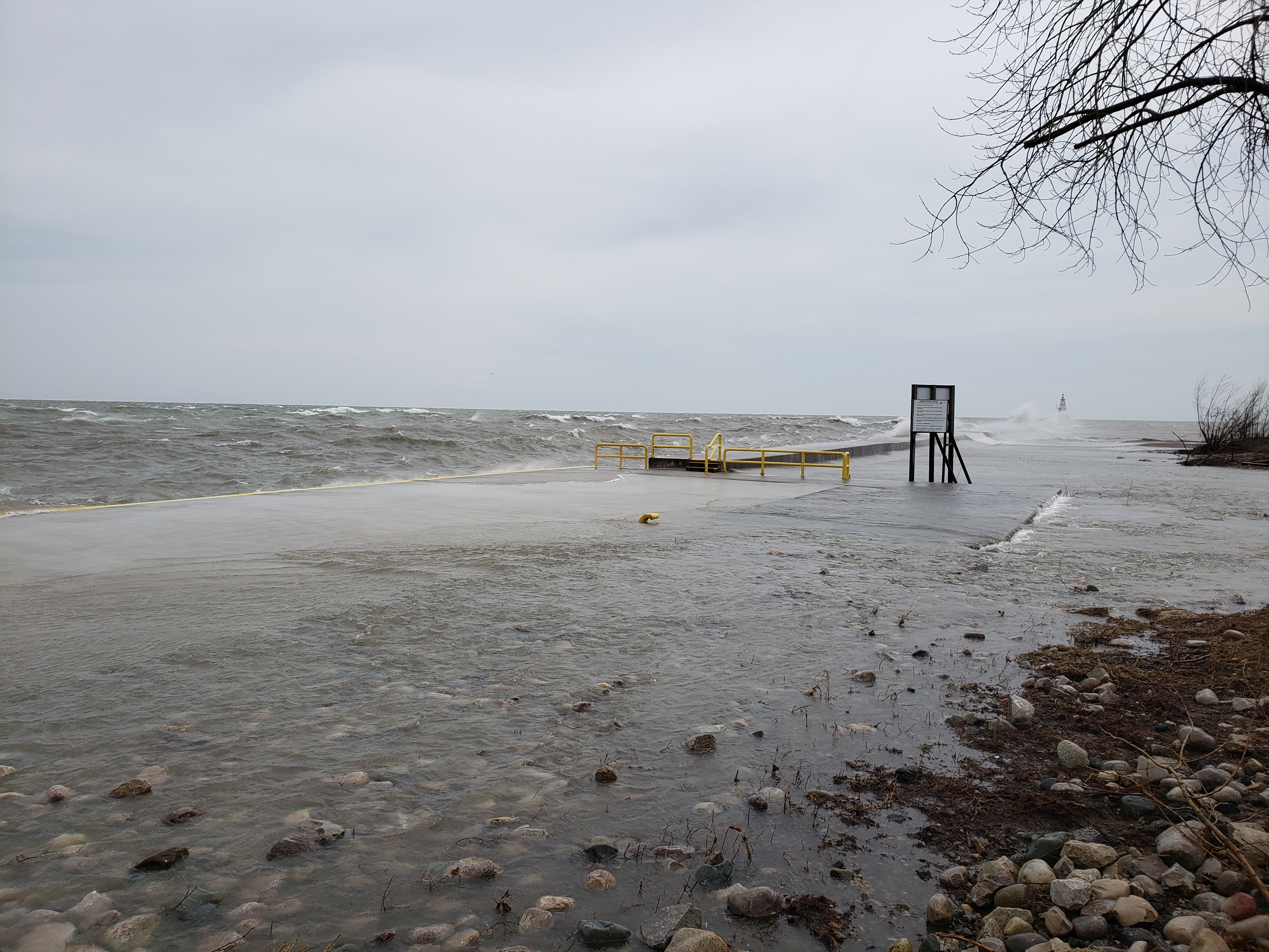
–     There is a risk of erosion and shoreline damage on Thursday.
–     There is a risk of minor flooding along Erie Shore Drive and along the west side of Rondeau on Thursday.

Environment Canada’s Marine Forecast has issued a Strong Wind Warning for Lake Erie with wind speeds over the lake around 37 km/hour and gusts up to 61 km/hour. Wave are expected to build to 1.5 meters this afternoon. The Marine Forecast has also issued a Squall Warning for Lake Erie with gusts expected up to 83 km/hour. Weather forecasts along the shoreline continue to change by the hour but there is the potential for sustained winds from the south or southwest of around 35 km/hour and gusts of up to 50 km/hour. Later in the day the winds are expected to shift to the west and diminish.

The risks associated with this event are related to wave action on south facing shorelines. Strong winds will be driving waves onto and along most of the Lake Erie shoreline in Chatham-Kent and Elgin County. There is a risk that wave action could damage shoreline protection works and cause shoreline erosion. Erie Shore Drive, the West side of Rondeau, and other low-lying shorelines could see flooding caused from spray when waves crash against and over shoreline protection works. Rondeau Bay Estates along the bay may be subject to increased wave attack. The high bluff areas of the shoreline will be subject to wave action for the entire period. Residents along the Lake Erie shoreline should pay attention to local conditions and prepare accordingly.

Should conditions get rough, people should take extra caution and avoid the shoreline. The waves can be strong and the shoreline slippery. There could also be hazardous debris within the waves and water which could be thrown onto the shoreline. Standing water can also present unseen hazards. Children and animals should be kept away from the water. Officials will continue to monitor the situation and update this advisory if necessary.

Contact: Jason Homewood (519-354-7310 x225, [email protected]) regarding this message.

This message will be in effect until May 24, 2019.

Share

What’s New?

  • Watershed Condition Statement – Safety Bulletin – Thames River – April 7, 2025 – 12:00 PM
  • Flood Watch – Thames River and smaller watercourses – April 6, 2025 – 1:00 PM
  • Flood Watch – Thames River and smaller watercourses – April 5, 2025 – 9:00 AM
  • Flood Watch – Thames River and smaller watercourses – April 3, 2025 – 3:00 PM
  • Watershed Condition Statement – Flood Outlook – Smaller watercourses and Thames River – April 1, 2025 – 2:00 PM

Facebook

What’s New?

  • Breakfast & BMPs – Register Today!
  • NEW! Funding for Farmers – 2025 Guide and Application Form
  • Create Something this March Break
  • Battle of Longwoods Returns to Longwoods Road Conservation Area
  • Birding at Big ‘O’

Partner Links

  • Lower Thames Valley Conservation Foundation
  • Conservation Ontario
  • Thames Heritage River; Canadian Heritage Rivers System
  • Chatham-Kent and Lambton Children’s Water Festival
  • Thames-Sydenham & Region Source Protection Area
  • Thames River Clear Water Revival

Connect with us!

Search

© 2025 · Lower Thames Valley Conservation Authority |[email protected] | Tel: 519-354-7310

  • Home
  • Privacy
  • Public Social Media Policy
  • Contact Form
Prev Next