• Home
  • About Us
    • Governance
      • About the LTVCA
      • Board of Directors
      • Board Meetings
      • Budget & Financial Statements
      • Public Consultation & Bids
      • Reports/ Plans/ Fees / MOUs
    • Get Involved
      • Employment
      • Volunteers
      • FAQ’s
      • What’s New?
  • Visit
    • Get Outside
      • Conservation Areas
      • Camping
      • Parking Passes
      • Healthy Hikes
    • Things to Do
      • Events
      • Ska-Nah-Doht Village & Museum
  • Conservation
    • Water Management
      • Flood Forecasting & Warning
      • LTVCA’s Flood Control Program
      • Water Control Structures
      • The History of Flooding
      • Flood Notices
      • Flood Notice Types
      • Water Levels
    • Conservation Services
      • Tree Planting
      • Grants for Landowners
      • Feature Partnership & Restoration Projects
      • Phosphorus Education
      • Funding for Farmers
      • Species at Risk
      • Invasive Species
      • Pollinator Habitats
      • Livestock Health
      • LIVING LAB – ONTARIO
  • Learning
    • Education Programs
      • School & Community Groups
      • On-the-Road Programs
      • Asynchronous Opportunities
      • Habitat Fact Resources
  • Planning & Regulations
    • Planning and Regs
      • Plan Input & Review
      • Regulations
      • Enforcement & Compliance
      • Regulated Areas Map
  • Contact Us
    • Get In Touch
      • Contact Form
      • Enforcement & Compliance
      • Staff Directory

Call us 519-354-7310

[email protected]
Lower Thames Valley Conservation AuthorityLower Thames Valley Conservation Authority
  • Home
  • About Us
    • Governance
      • About the LTVCA
      • Board of Directors
      • Board Meetings
      • Budget & Financial Statements
      • Public Consultation & Bids
      • Reports/ Plans/ Fees / MOUs
    • Get Involved
      • Employment
      • Volunteers
      • FAQ’s
      • What’s New?
  • Visit
    • Get Outside
      • Conservation Areas
      • Camping
      • Parking Passes
      • Healthy Hikes
    • Things to Do
      • Events
      • Ska-Nah-Doht Village & Museum
  • Conservation
    • Water Management
      • Flood Forecasting & Warning
      • LTVCA’s Flood Control Program
      • Water Control Structures
      • The History of Flooding
      • Flood Notices
      • Flood Notice Types
      • Water Levels
    • Conservation Services
      • Tree Planting
      • Grants for Landowners
      • Feature Partnership & Restoration Projects
      • Phosphorus Education
      • Funding for Farmers
      • Species at Risk
      • Invasive Species
      • Pollinator Habitats
      • Livestock Health
      • LIVING LAB – ONTARIO
  • Learning
    • Education Programs
      • School & Community Groups
      • On-the-Road Programs
      • Asynchronous Opportunities
      • Habitat Fact Resources
  • Planning & Regulations
    • Planning and Regs
      • Plan Input & Review
      • Regulations
      • Enforcement & Compliance
      • Regulated Areas Map
  • Contact Us
    • Get In Touch
      • Contact Form
      • Enforcement & Compliance
      • Staff Directory

Watershed Conditions – Safety Bulletin – January 24th, 2018 – 1:30 PM

Home » Watershed Conditions – Safety Bulletin – January 24th, 2018 – 1:30 PM
Thames River Feb.2 2016

Watershed Conditions – Safety Bulletin – January 24th, 2018 – 1:30 PM

January 24, 2018

On Monday and Tuesday, areas in the Lower Thames watershed experienced warm temperatures and somewhere between 15 and 35 mm of rain. Temperatures are expected to remain below freezing today and tomorrow and then rise above freezing for Friday through the weekend. Currently there is 5 mm of rain expected on Saturday.

Now that the warm temperatures and rain have passed, water levels on all the region’s smaller local watercourses are dropping. In some areas water levels remain high due to snow and ice blockages in those watercourses. The predicted rain for the weekend will cause water levels to rise again, but not high enough to spill their banks unless snow and ice blockages cause problems.

Water levels on the Thames River peaked in the City of London overnight. That water will work its way downstream over the next few days, peaking in Thamesville and Chatham over the weekend. The flows coming downstream are not typically associated with flooding, except in the most low-lying areas adjacent to the river. However, there are large accumulations of broken ice in the river beginning just downstream of Thamesville and extending upstream almost to the Chatham-Kent / Middlesex / Elgin border. This ice accumulation caused elevated water levels through this stretch and some distance upstream during last week’s high water event, and is likely to do so again. Some flooding of the low-lying river flats adjacent to river should be expected as the water makes its way downstream.

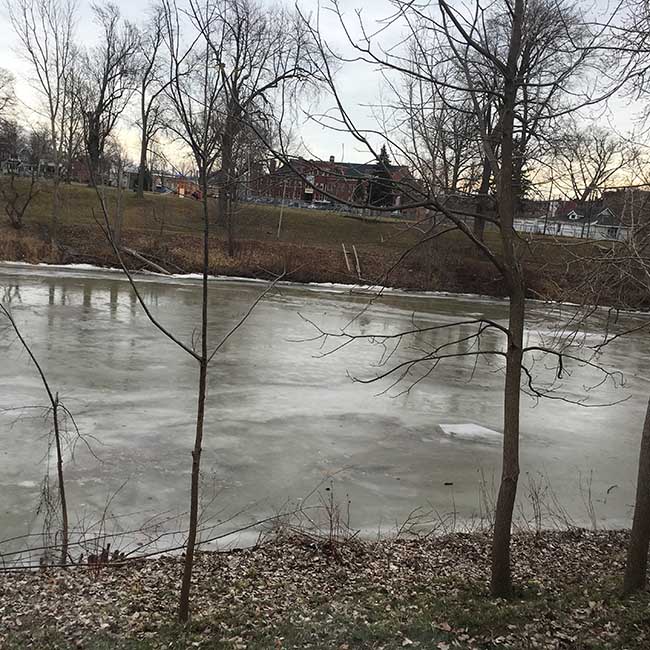
While there is still ice on the Thames River from the Kent Bridge area down to the mouth, the ice has degraded due to the warm temperatures and rainfall. Large areas of open water have appeared where the ice has melted out and even stretches that look intact are probably unsafe. Conditions are expected to degrade even further over the weekend.

People should take extra caution and avoid the river, ditches, and streams. The combination of slippery banks, broken or unstable ice and fast moving cold water can be dangerous. Standing water can also present its own unseen hazards. Children and pets should be kept away from the water.

Officials will continue to monitor the situation and update this advisory if necessary.
This message will be in effect until January 29th, 2018.

Contact: Jason Wintermute (519-354-7310 x 227, [email protected]) regarding this message.

Share

What’s New?

  • Watershed Condition Statement – Safety Bulletin – Thames River – April 7, 2025 – 12:00 PM
  • Flood Watch – Thames River and smaller watercourses – April 6, 2025 – 1:00 PM
  • Flood Watch – Thames River and smaller watercourses – April 5, 2025 – 9:00 AM
  • Flood Watch – Thames River and smaller watercourses – April 3, 2025 – 3:00 PM
  • Watershed Condition Statement – Flood Outlook – Smaller watercourses and Thames River – April 1, 2025 – 2:00 PM

Facebook

What’s New?

  • Breakfast & BMPs – Register Today!
  • NEW! Funding for Farmers – 2025 Guide and Application Form
  • Create Something this March Break
  • Battle of Longwoods Returns to Longwoods Road Conservation Area
  • Birding at Big ‘O’

Partner Links

  • Lower Thames Valley Conservation Foundation
  • Conservation Ontario
  • Thames Heritage River; Canadian Heritage Rivers System
  • Chatham-Kent and Lambton Children’s Water Festival
  • Thames-Sydenham & Region Source Protection Area
  • Thames River Clear Water Revival

Connect with us!

Search

© 2025 · Lower Thames Valley Conservation Authority |[email protected] | Tel: 519-354-7310

  • Home
  • Privacy
  • Public Social Media Policy
  • Contact Form
Prev Next