• Home
  • About Us
    • Governance
      • About the LTVCA
      • Board of Directors
      • Board Meetings
      • Budget & Financial Statements
      • Public Consultation & Bids
      • Reports/ Plans/ Fees / MOUs
    • Get Involved
      • Employment
      • Volunteers
      • FAQ’s
      • What’s New?
  • Visit
    • Get Outside
      • Conservation Areas
      • Camping
      • Parking Passes
      • Healthy Hikes
    • Things to Do
      • Events
      • Ska-Nah-Doht Village & Museum
  • Conservation
    • Water Management
      • Flood Forecasting & Warning
      • LTVCA’s Flood Control Program
      • Water Control Structures
      • The History of Flooding
      • Flood Notices
      • Flood Notice Types
      • Water Levels
    • Conservation Services
      • Tree Planting
      • Grants for Landowners
      • Feature Partnership & Restoration Projects
      • Phosphorus Education
      • Funding for Farmers
      • Species at Risk
      • Invasive Species
      • Pollinator Habitats
      • Livestock Health
      • LIVING LAB – ONTARIO
  • Learning
    • Education Programs
      • School & Community Groups
      • On-the-Road Programs
      • Asynchronous Opportunities
      • Habitat Fact Resources
  • Planning & Regulations
    • Planning and Regs
      • Plan Input & Review
      • Regulations
      • Enforcement & Compliance
      • Regulated Areas Map
  • Contact Us
    • Get In Touch
      • Contact Form
      • Enforcement & Compliance
      • Staff Directory

Call us 519-354-7310

[email protected]
Lower Thames Valley Conservation AuthorityLower Thames Valley Conservation Authority
  • Home
  • About Us
    • Governance
      • About the LTVCA
      • Board of Directors
      • Board Meetings
      • Budget & Financial Statements
      • Public Consultation & Bids
      • Reports/ Plans/ Fees / MOUs
    • Get Involved
      • Employment
      • Volunteers
      • FAQ’s
      • What’s New?
  • Visit
    • Get Outside
      • Conservation Areas
      • Camping
      • Parking Passes
      • Healthy Hikes
    • Things to Do
      • Events
      • Ska-Nah-Doht Village & Museum
  • Conservation
    • Water Management
      • Flood Forecasting & Warning
      • LTVCA’s Flood Control Program
      • Water Control Structures
      • The History of Flooding
      • Flood Notices
      • Flood Notice Types
      • Water Levels
    • Conservation Services
      • Tree Planting
      • Grants for Landowners
      • Feature Partnership & Restoration Projects
      • Phosphorus Education
      • Funding for Farmers
      • Species at Risk
      • Invasive Species
      • Pollinator Habitats
      • Livestock Health
      • LIVING LAB – ONTARIO
  • Learning
    • Education Programs
      • School & Community Groups
      • On-the-Road Programs
      • Asynchronous Opportunities
      • Habitat Fact Resources
  • Planning & Regulations
    • Planning and Regs
      • Plan Input & Review
      • Regulations
      • Enforcement & Compliance
      • Regulated Areas Map
  • Contact Us
    • Get In Touch
      • Contact Form
      • Enforcement & Compliance
      • Staff Directory

Watershed Conditions – Safety Bulletin – February 2nd, 2016 – 10:30 a.m.

Home » Watershed Conditions – Safety Bulletin – February 2nd, 2016 – 10:30 a.m.
Thames River Feb.2 2016

Watershed Conditions – Safety Bulletin – February 2nd, 2016 – 10:30 a.m.

February 2, 2016

Date: 10:30 A.M., Tuesday, February 2, 2016

Issued to: Municipal Flood Coordinators of Municipalities, Media

Issued by: Lower Thames Valley Conservation Authority

Over the last few days the Thames River watershed has experienced unseasonably high temperatures with average daily temperatures over 5⁰C and daytime highs around 10⁰C.  Snow surveys conducted before the warm up indicated 30-35 mm of water equivalent in the snowpack of the north and 5-15 mm in the south of the Upper Thames.  The high temperatures have caused the snow to melt and to release this water and water levels on the Thames River have risen in response.  Snow surveys yesterday indicated the snow has mostly all melted out of the south with 10-15 mm of water equivalent remaining in the northerly areas of the watershed.  Rainfall for this evening and overnight are calling for 20-25 mm of rain with the continuation of high temperatures into tomorrow.

The predicted rainfall for this evening and overnight is expected to add to the elevated water levels already being seen in the Thames River due to the snowmelt.  Water levels could raise enough to flood the low lying river flats areas adjacent to the Thames River from Delaware, beginning overnight, and making their way down to Thamesville over the next couple of days.  After the peak flows pass, water levels should be expected to remain high throughout the rest of the week.  While there is ice cover on the Thames River, it has not accumulated a significant thickness, and therefore large ice jamming events are not expected.  However, localized ice jam events could occur and would be expected to be limited to the low lying areas previously mentioned.

The predicted 20-25 mm of rainfall can be a significant amount for the local watersheds in the winter when snow and frozen ground conditions exist.  With only limited snow in the Lower Thames watershed and the recent high temperatures, the impact of this rainfall may not be as severe.  Local drainage ditches and watercourse are expected to rise and may spill their banks.  Although the LTVCA does not expect to have to operate, the Indian-McGregor Creek Diversion Channel, there is still some uncertainty and staff will be monitoring conditions closely.

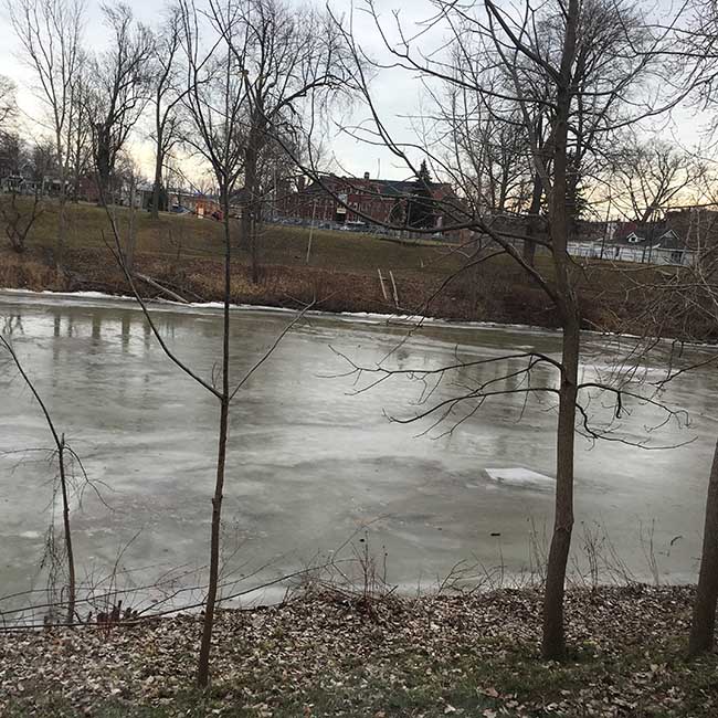
People should take extra caution and avoid the river, lakes, ditches, streams, and ponds.  Ice conditions are expected to degrade and a combination of slippery banks, moving/melting ice and cold water is particularly dangerous.   Children, pets and livestock should be kept away from the water.

Officials will continue to monitor the situation and update this advisory if necessary.

This message will be in effect until February 4th, 2016.

Contact:  Jason Wintermute ([email protected], 519-354-7310 x227) regarding this message.

Share

What’s New?

  • Watershed Condition Statement – Safety Bulletin – Thames River – April 7, 2025 – 12:00 PM
  • Flood Watch – Thames River and smaller watercourses – April 6, 2025 – 1:00 PM
  • Flood Watch – Thames River and smaller watercourses – April 5, 2025 – 9:00 AM
  • Flood Watch – Thames River and smaller watercourses – April 3, 2025 – 3:00 PM
  • Watershed Condition Statement – Flood Outlook – Smaller watercourses and Thames River – April 1, 2025 – 2:00 PM

Facebook

What’s New?

  • Breakfast & BMPs – Register Today!
  • NEW! Funding for Farmers – 2025 Guide and Application Form
  • Create Something this March Break
  • Battle of Longwoods Returns to Longwoods Road Conservation Area
  • Birding at Big ‘O’

Partner Links

  • Lower Thames Valley Conservation Foundation
  • Conservation Ontario
  • Thames Heritage River; Canadian Heritage Rivers System
  • Chatham-Kent and Lambton Children’s Water Festival
  • Thames-Sydenham & Region Source Protection Area
  • Thames River Clear Water Revival

Connect with us!

Search

© 2025 · Lower Thames Valley Conservation Authority |[email protected] | Tel: 519-354-7310

  • Home
  • Privacy
  • Public Social Media Policy
  • Contact Form
Prev Next