• Home
  • About Us
    • Governance
      • About the LTVCA
      • Board of Directors
      • Board Meetings
      • Budget & Financial Statements
      • Public Consultation & Bids
      • Reports/ Plans/ Fees / MOUs
    • Get Involved
      • Employment
      • Volunteers
      • FAQ’s
      • What’s New?
  • Visit
    • Get Outside
      • Conservation Areas
      • Camping
      • Parking Passes
      • Healthy Hikes
    • Things to Do
      • Events
      • Ska-Nah-Doht Village & Museum
  • Conservation
    • Water Management
      • Flood Forecasting & Warning
      • LTVCA’s Flood Control Program
      • Water Control Structures
      • The History of Flooding
      • Flood Notices
      • Flood Notice Types
      • Water Levels
    • Conservation Services
      • Tree Planting
      • Grants for Landowners
      • Feature Partnership & Restoration Projects
      • Phosphorus Education
      • Funding for Farmers
      • Species at Risk
      • Invasive Species
      • Pollinator Habitats
      • Livestock Health
      • LIVING LAB – ONTARIO
  • Learning
    • Education Programs
      • School & Community Groups
      • On-the-Road Programs
      • Asynchronous Opportunities
      • Habitat Fact Resources
  • Planning & Regulations
    • Planning and Regs
      • Plan Input & Review
      • Regulations
      • Enforcement & Compliance
      • Regulated Areas Map
  • Contact Us
    • Get In Touch
      • Contact Form
      • Enforcement & Compliance
      • Staff Directory

Call us 519-354-7310

[email protected]
Lower Thames Valley Conservation AuthorityLower Thames Valley Conservation Authority
  • Home
  • About Us
    • Governance
      • About the LTVCA
      • Board of Directors
      • Board Meetings
      • Budget & Financial Statements
      • Public Consultation & Bids
      • Reports/ Plans/ Fees / MOUs
    • Get Involved
      • Employment
      • Volunteers
      • FAQ’s
      • What’s New?
  • Visit
    • Get Outside
      • Conservation Areas
      • Camping
      • Parking Passes
      • Healthy Hikes
    • Things to Do
      • Events
      • Ska-Nah-Doht Village & Museum
  • Conservation
    • Water Management
      • Flood Forecasting & Warning
      • LTVCA’s Flood Control Program
      • Water Control Structures
      • The History of Flooding
      • Flood Notices
      • Flood Notice Types
      • Water Levels
    • Conservation Services
      • Tree Planting
      • Grants for Landowners
      • Feature Partnership & Restoration Projects
      • Phosphorus Education
      • Funding for Farmers
      • Species at Risk
      • Invasive Species
      • Pollinator Habitats
      • Livestock Health
      • LIVING LAB – ONTARIO
  • Learning
    • Education Programs
      • School & Community Groups
      • On-the-Road Programs
      • Asynchronous Opportunities
      • Habitat Fact Resources
  • Planning & Regulations
    • Planning and Regs
      • Plan Input & Review
      • Regulations
      • Enforcement & Compliance
      • Regulated Areas Map
  • Contact Us
    • Get In Touch
      • Contact Form
      • Enforcement & Compliance
      • Staff Directory

Watershed Conditions – Flood Outlook – January 12th, 2017 – 2:30 p.m.

Home » Watershed Conditions – Flood Outlook – January 12th, 2017 – 2:30 p.m.
Jan 12 2017 Thames River

Watershed Conditions – Flood Outlook – January 12th, 2017 – 2:30 p.m.

January 12, 2017

Overnight, the Lower Thames watershed received only a few mm of rain, much less than predicted.  The weather system moving through around noon has dropped around 10 mm of rain, more than predicted.  Most of the snow has already melted away.  However, the Upper Thames watershed did receive the predicted rainfall amounts, in some areas perhaps even more than predicted, and there was more water stored in the snowpack there.  Forecasts are not calling for any more rain for the next few days.  Temperatures are expected to drop beneath freezing for the next few days as well.

The smaller local watercourses can still be expected to rise due to today’s rainfall.  Some of these watercourses still have ice cover and that ice can be expected to break up and flow away, then refreeze over the weekend.  Localized flooding may occur due to the recent rainfall aggravated by any drainage blockages.  The Lower Thames Valley Conservation Authority is monitoring conditions to determine whether the Indian-McGregor Creek Diversion Channel will need to be operated.

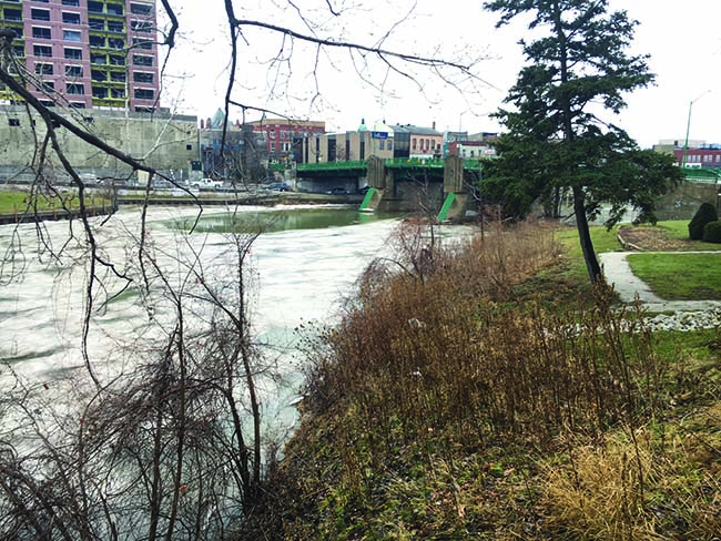
Water levels on the Thames River can also be expected to rise in response to this event.  Water levels on the Thames River in the City of London are expected to peak Friday morning.  As this water makes it way downstream, water levels can be expected to remain high through the weekend and into early next week.  Conditions similar to a normal spring melt event should be expected.  Water levels will rise and flood the river flats from Delaware to Chatham.  The upper tablelands will not see flooding.  In the City of Chatham, the sidewalk along the river between 5th Street and the municipal offices will be flooded over.  The access road beneath the 5th St. bridge will also likely be under water.  The basements of the businesses on King St. that back onto the river should remain unaffected.  As most of the ice cover on the Thames River has already disappeared, issues with ice jamming are not expected.

Unfortunately, over the holidays, there was vandalism at the Water Survey of Canada / LTVCA water level gauge in the City of Chatham.  While the LTVCA will be able to make due with other tools, there will not be an accurate historical record of this event.

People should take extra caution and avoid the river, ditches, and streams.  The combination of slippery banks, unstable ice and fast moving cold water can be dangerous.  Standing water can also present its own unseen hazards.  Children, pets and livestock should be kept away from the water.

Officials will continue to monitor the situation and update this advisory if necessary.

This message will be in effect until January 19th, 2017.

Contact:  Jason Wintermute (519- 354-7310 x227) regarding this message.

Share

What’s New?

  • Watershed Condition Statement – Safety Bulletin – Thames River – April 7, 2025 – 12:00 PM
  • Flood Watch – Thames River and smaller watercourses – April 6, 2025 – 1:00 PM
  • Flood Watch – Thames River and smaller watercourses – April 5, 2025 – 9:00 AM
  • Flood Watch – Thames River and smaller watercourses – April 3, 2025 – 3:00 PM
  • Watershed Condition Statement – Flood Outlook – Smaller watercourses and Thames River – April 1, 2025 – 2:00 PM

Facebook

What’s New?

  • Breakfast & BMPs – Register Today!
  • NEW! Funding for Farmers – 2025 Guide and Application Form
  • Create Something this March Break
  • Battle of Longwoods Returns to Longwoods Road Conservation Area
  • Birding at Big ‘O’

Partner Links

  • Lower Thames Valley Conservation Foundation
  • Conservation Ontario
  • Thames Heritage River; Canadian Heritage Rivers System
  • Chatham-Kent and Lambton Children’s Water Festival
  • Thames-Sydenham & Region Source Protection Area
  • Thames River Clear Water Revival

Connect with us!

Search

© 2025 · Lower Thames Valley Conservation Authority |[email protected] | Tel: 519-354-7310

  • Home
  • Privacy
  • Public Social Media Policy
  • Contact Form
Prev Next