• Home
  • About Us
    • Governance
      • About the LTVCA
      • Board of Directors
      • Board Meetings
      • Budget & Financial Statements
      • Public Consultation & Bids
      • Reports/ Plans/ Fees / MOUs
    • Get Involved
      • Employment
      • Volunteers
      • FAQ’s
      • What’s New?
  • Visit
    • Get Outside
      • Conservation Areas
      • Camping
      • Parking Passes
      • Healthy Hikes
    • Things to Do
      • Events
      • Ska-Nah-Doht Village & Museum
  • Conservation
    • Water Management
      • Flood Forecasting & Warning
      • LTVCA’s Flood Control Program
      • Water Control Structures
      • The History of Flooding
      • Flood Notices
      • Flood Notice Types
      • Water Levels
    • Conservation Services
      • Tree Planting
      • Grants for Landowners
      • Feature Partnership & Restoration Projects
      • Phosphorus Education
      • Funding for Farmers
      • Species at Risk
      • Invasive Species
      • Pollinator Habitats
      • Livestock Health
      • LIVING LAB – ONTARIO
  • Learning
    • Education Programs
      • School & Community Groups
      • On-the-Road Programs
      • Asynchronous Opportunities
      • Habitat Fact Resources
  • Planning & Regulations
    • Planning and Regs
      • Plan Input & Review
      • Regulations
      • Enforcement & Compliance
      • Regulated Areas Map
  • Contact Us
    • Get In Touch
      • Contact Form
      • Enforcement & Compliance
      • Staff Directory

Call us 519-354-7310

[email protected]
Lower Thames Valley Conservation AuthorityLower Thames Valley Conservation Authority
  • Home
  • About Us
    • Governance
      • About the LTVCA
      • Board of Directors
      • Board Meetings
      • Budget & Financial Statements
      • Public Consultation & Bids
      • Reports/ Plans/ Fees / MOUs
    • Get Involved
      • Employment
      • Volunteers
      • FAQ’s
      • What’s New?
  • Visit
    • Get Outside
      • Conservation Areas
      • Camping
      • Parking Passes
      • Healthy Hikes
    • Things to Do
      • Events
      • Ska-Nah-Doht Village & Museum
  • Conservation
    • Water Management
      • Flood Forecasting & Warning
      • LTVCA’s Flood Control Program
      • Water Control Structures
      • The History of Flooding
      • Flood Notices
      • Flood Notice Types
      • Water Levels
    • Conservation Services
      • Tree Planting
      • Grants for Landowners
      • Feature Partnership & Restoration Projects
      • Phosphorus Education
      • Funding for Farmers
      • Species at Risk
      • Invasive Species
      • Pollinator Habitats
      • Livestock Health
      • LIVING LAB – ONTARIO
  • Learning
    • Education Programs
      • School & Community Groups
      • On-the-Road Programs
      • Asynchronous Opportunities
      • Habitat Fact Resources
  • Planning & Regulations
    • Planning and Regs
      • Plan Input & Review
      • Regulations
      • Enforcement & Compliance
      • Regulated Areas Map
  • Contact Us
    • Get In Touch
      • Contact Form
      • Enforcement & Compliance
      • Staff Directory

Watershed Conditions – Flood Outlook – – February 5, 2019 – 5:30 p.m.

Home » Watershed Conditions – Flood Outlook – – February 5, 2019 – 5:30 p.m.
a view of the Thames River mouth with ice

Watershed Conditions – Flood Outlook – – February 5, 2019 – 5:30 p.m.

February 5, 2019

Highlights:

• Thames River will rise and flood the low lying river flats from Delaware down the Chatham.
• Ice cover on the Thames River will break up and may cause minor ice jams.
• Water levels on smaller local watercourses are now dropping but ice and snow blockages and related flooding are still possible.
• Rain in the forecast will keep water levels high throughout the week and may aggravate any ice jamming.

Message:

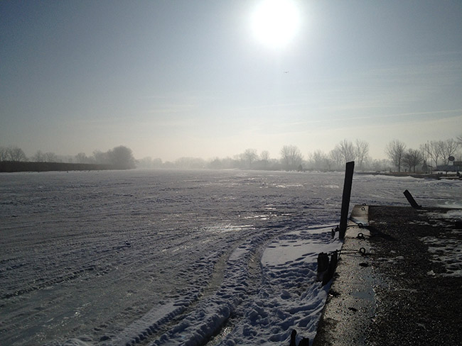
Over the last few days the Thames River watershed has experienced a warm spell. The warm temperatures have melted most of the snow in the Lower Thames watershed. In addition to the melted snow, late yesterday afternoon and evening the watershed received 5 to 15 mm of rainfall. Temperatures are now expected to remain below freezing until tomorrow afternoon, and then hover around the freezing point until another brief warm spell late Thursday, before dropping back below freezing Friday and through the weekend. Weather forecasts are calling for 5 mm of freezing rain overnight, a 10-15 mm of freezing rain tomorrow and another 10-15 mm of rain on Thursday. Before this warm up, many of the region’s smaller watercourses were filled with snow and ice. Ice cover on the Thames River was around 15 to 20 cm thick, possibly up to 30 cm around the mouth at Lighthouse Cove.

On the region’s smaller watercourses, water levels had risen and many had approached bank full conditions. In some areas, blockages of ice and snow had caused water to spill out of their banks. Water levels on these smaller watercourses now appear to be dropping. Blockages on McGregor Creek upstream of Chatham had caused water to spill out into the low lying flood flats, but water levels now appear to be dropping there too. Water levels are still high and should be expected to remain high over the next few days given the rainfall forecasts. The potential still exists for further ice blockages and localized flooding later this week.

Water levels on the Thames River in the City of London are expected to peak overnight. The amount of water leaving the Upper Thames watershed will cause flooding of the low lying river flats adjacent to the river from Delaware down to Chatham, beginning in the upper reaches tomorrow and making their way down to Chatham by Friday. Currently the ice on the Thames River appears largely intact. However, the warm weather and rain has weakened the ice particularly along the shorelines. In addition, flows on the Thames River are high enough that the ice will break up and begin to move downstream. There is the potential for minor ice jamming as the ice pushes its way downstream, which could lead to higher than expected water levels and additional water in the flood flats. The additional rainfall in the forecast would raise water levels even further and could lead to more ice jamming.

People should take extra caution and avoid the river, ditches, and streams. The combination of slippery banks, broken or unstable ice and fast moving cold water can be dangerous. Standing water can also present its own unseen hazards. Children and pets and livestock should be kept away from the water.

Officials will continue to monitor the situation and update this advisory if necessary.
This message will be in effect until February 9th, 2019.

Contact: Jason Wintermute (519-354-7310 x227, [email protected]) regarding this message.

Share

What’s New?

  • Watershed Condition Statement – Safety Bulletin – Thames River – April 7, 2025 – 12:00 PM
  • Flood Watch – Thames River and smaller watercourses – April 6, 2025 – 1:00 PM
  • Flood Watch – Thames River and smaller watercourses – April 5, 2025 – 9:00 AM
  • Flood Watch – Thames River and smaller watercourses – April 3, 2025 – 3:00 PM
  • Watershed Condition Statement – Flood Outlook – Smaller watercourses and Thames River – April 1, 2025 – 2:00 PM

Facebook

What’s New?

  • Breakfast & BMPs – Register Today!
  • NEW! Funding for Farmers – 2025 Guide and Application Form
  • Create Something this March Break
  • Battle of Longwoods Returns to Longwoods Road Conservation Area
  • Birding at Big ‘O’

Partner Links

  • Lower Thames Valley Conservation Foundation
  • Conservation Ontario
  • Thames Heritage River; Canadian Heritage Rivers System
  • Chatham-Kent and Lambton Children’s Water Festival
  • Thames-Sydenham & Region Source Protection Area
  • Thames River Clear Water Revival

Connect with us!

Search

© 2025 · Lower Thames Valley Conservation Authority |[email protected] | Tel: 519-354-7310

  • Home
  • Privacy
  • Public Social Media Policy
  • Contact Form
Prev Next