• Home
  • About Us
    • Governance
      • About the LTVCA
      • Board of Directors
      • Board Meetings
      • Budget & Financial Statements
      • Public Consultation & Bids
      • Reports/ Plans/ Fees / MOUs
    • Get Involved
      • Employment
      • Volunteers
      • FAQ’s
      • What’s New?
  • Visit
    • Get Outside
      • Conservation Areas
      • Camping
      • Parking Passes
      • Healthy Hikes
    • Things to Do
      • Events
      • Ska-Nah-Doht Village & Museum
  • Conservation
    • Water Management
      • Flood Forecasting & Warning
      • LTVCA’s Flood Control Program
      • Water Control Structures
      • The History of Flooding
      • Flood Notices
      • Flood Notice Types
      • Water Levels
    • Conservation Services
      • Tree Planting
      • Grants for Landowners
      • Feature Partnership & Restoration Projects
      • Phosphorus Education
      • Funding for Farmers
      • Species at Risk
      • Invasive Species
      • Pollinator Habitats
      • Livestock Health
      • LIVING LAB – ONTARIO
  • Learning
    • Education Programs
      • School & Community Groups
      • On-the-Road Programs
      • Asynchronous Opportunities
      • Habitat Fact Resources
  • Planning & Regulations
    • Planning and Regs
      • Plan Input & Review
      • Regulations
      • Enforcement & Compliance
      • Regulated Areas Map
  • Contact Us
    • Get In Touch
      • Contact Form
      • Enforcement & Compliance
      • Staff Directory

Call us 519-354-7310

[email protected]
Lower Thames Valley Conservation AuthorityLower Thames Valley Conservation Authority
  • Home
  • About Us
    • Governance
      • About the LTVCA
      • Board of Directors
      • Board Meetings
      • Budget & Financial Statements
      • Public Consultation & Bids
      • Reports/ Plans/ Fees / MOUs
    • Get Involved
      • Employment
      • Volunteers
      • FAQ’s
      • What’s New?
  • Visit
    • Get Outside
      • Conservation Areas
      • Camping
      • Parking Passes
      • Healthy Hikes
    • Things to Do
      • Events
      • Ska-Nah-Doht Village & Museum
  • Conservation
    • Water Management
      • Flood Forecasting & Warning
      • LTVCA’s Flood Control Program
      • Water Control Structures
      • The History of Flooding
      • Flood Notices
      • Flood Notice Types
      • Water Levels
    • Conservation Services
      • Tree Planting
      • Grants for Landowners
      • Feature Partnership & Restoration Projects
      • Phosphorus Education
      • Funding for Farmers
      • Species at Risk
      • Invasive Species
      • Pollinator Habitats
      • Livestock Health
      • LIVING LAB – ONTARIO
  • Learning
    • Education Programs
      • School & Community Groups
      • On-the-Road Programs
      • Asynchronous Opportunities
      • Habitat Fact Resources
  • Planning & Regulations
    • Planning and Regs
      • Plan Input & Review
      • Regulations
      • Enforcement & Compliance
      • Regulated Areas Map
  • Contact Us
    • Get In Touch
      • Contact Form
      • Enforcement & Compliance
      • Staff Directory

Watershed Conditions – Flood Outlook – February 28, 2018 – 2:00 PM

Home » Watershed Conditions – Flood Outlook – February 28, 2018 – 2:00 PM
Diversion channel flood waters entering Thames River

Watershed Conditions – Flood Outlook – February 28, 2018 – 2:00 PM

February 28, 2018

Warm temperatures, melting snow and heavy rainfall last week led to large amounts of flooding in the Thames River watershed. All the snow in the Thames watershed has now melted and there is no longer any ice cover on the Thames River. Weather forecasts are calling for mixed precipitation between 15 and 45 mm of water equivalent. The further north in the watershed, the less precipitation is expected and the larger the proportion of snow is expected. The Chatham area could see 10 cm as snow and 35 as rain, whereas closer to London it could be 20 cm of snow and 10 mm of rain. Environment Canada has issued a Special Weather Statement due to the predicted precipitation.

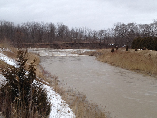
Water levels on the Thames River have dropped throughout the watershed, from the upper reaches down to the mouth at Lighthouse Cove. The Lower Thames Valley Conservation Authority ceased operations of the 6th St. Backwater Dam and Pumping Station Monday evening and the Indian-McGregor Creek Diversion Channel yesterday morning.

The amount of precipitation and whether it comes down as rain or snow will largely determine the impacts in the watershed. With the lower amounts of rainfall and more snow, the region would experience a modest rise in water levels on the region’s smaller local watercourses. If the higher amounts of rainfall appear, the local watercourse could be expected to rise rapidly and some could spill their banks. Higher amounts of rainfall could also require the operation of the Indian-McGregor Creek Diversion Channel again. Some areas have not had a chance to clean up from the flooding earlier this week and there is a chance that flood debris could cause blockages and aggravate high water levels. Attempts should also be made to ensure that catch basins and other drainage works are free of debris and can function properly.

Water levels on the Thames River itself are not expected to rise up any significant amount.

People should take extra caution and avoid the river, ditches, and streams. The combination of slippery banks, floating debris and fast moving cold water can be dangerous. Standing water can also present its own unseen hazards. Children and pets should be kept away from the water.

Officials will continue to monitor the situation and update this advisory if necessary.
This message will be in effect until March 3rd, 2018.

Contact: Jason Wintermute (519-354-7310 x 227, [email protected]) regarding this message.

Share

What’s New?

  • Watershed Condition Statement – Safety Bulletin – Thames River – April 7, 2025 – 12:00 PM
  • Flood Watch – Thames River and smaller watercourses – April 6, 2025 – 1:00 PM
  • Flood Watch – Thames River and smaller watercourses – April 5, 2025 – 9:00 AM
  • Flood Watch – Thames River and smaller watercourses – April 3, 2025 – 3:00 PM
  • Watershed Condition Statement – Flood Outlook – Smaller watercourses and Thames River – April 1, 2025 – 2:00 PM

Facebook

What’s New?

  • Breakfast & BMPs – Register Today!
  • NEW! Funding for Farmers – 2025 Guide and Application Form
  • Create Something this March Break
  • Battle of Longwoods Returns to Longwoods Road Conservation Area
  • Birding at Big ‘O’

Partner Links

  • Lower Thames Valley Conservation Foundation
  • Conservation Ontario
  • Thames Heritage River; Canadian Heritage Rivers System
  • Chatham-Kent and Lambton Children’s Water Festival
  • Thames-Sydenham & Region Source Protection Area
  • Thames River Clear Water Revival

Connect with us!

Search

© 2025 · Lower Thames Valley Conservation Authority |[email protected] | Tel: 519-354-7310

  • Home
  • Privacy
  • Public Social Media Policy
  • Contact Form
Prev Next