• Home
  • About Us
    • Governance
      • About the LTVCA
      • Board of Directors
      • Board Meetings
      • Budget & Financial Statements
      • Public Consultation & Bids
      • Reports/ Plans/ Fees / MOUs
    • Get Involved
      • Employment
      • Volunteers
      • FAQ’s
      • What’s New?
  • Visit
    • Get Outside
      • Conservation Areas
      • Camping
      • Parking Passes
      • Healthy Hikes
    • Things to Do
      • Events
      • Ska-Nah-Doht Village & Museum
  • Conservation
    • Water Management
      • Flood Forecasting & Warning
      • LTVCA’s Flood Control Program
      • Water Control Structures
      • The History of Flooding
      • Flood Notices
      • Flood Notice Types
      • Water Levels
    • Conservation Services
      • Tree Planting
      • Grants for Landowners
      • Feature Partnership & Restoration Projects
      • Phosphorus Education
      • Funding for Farmers
      • Species at Risk
      • Invasive Species
      • Pollinator Habitats
      • Livestock Health
      • LIVING LAB – ONTARIO
  • Learning
    • Education Programs
      • School & Community Groups
      • On-the-Road Programs
      • Asynchronous Opportunities
      • Habitat Fact Resources
  • Planning & Regulations
    • Planning and Regs
      • Plan Input & Review
      • Regulations
      • Enforcement & Compliance
      • Regulated Areas Map
  • Contact Us
    • Get In Touch
      • Contact Form
      • Enforcement & Compliance
      • Staff Directory

Call us 519-354-7310

[email protected]
Lower Thames Valley Conservation AuthorityLower Thames Valley Conservation Authority
  • Home
  • About Us
    • Governance
      • About the LTVCA
      • Board of Directors
      • Board Meetings
      • Budget & Financial Statements
      • Public Consultation & Bids
      • Reports/ Plans/ Fees / MOUs
    • Get Involved
      • Employment
      • Volunteers
      • FAQ’s
      • What’s New?
  • Visit
    • Get Outside
      • Conservation Areas
      • Camping
      • Parking Passes
      • Healthy Hikes
    • Things to Do
      • Events
      • Ska-Nah-Doht Village & Museum
  • Conservation
    • Water Management
      • Flood Forecasting & Warning
      • LTVCA’s Flood Control Program
      • Water Control Structures
      • The History of Flooding
      • Flood Notices
      • Flood Notice Types
      • Water Levels
    • Conservation Services
      • Tree Planting
      • Grants for Landowners
      • Feature Partnership & Restoration Projects
      • Phosphorus Education
      • Funding for Farmers
      • Species at Risk
      • Invasive Species
      • Pollinator Habitats
      • Livestock Health
      • LIVING LAB – ONTARIO
  • Learning
    • Education Programs
      • School & Community Groups
      • On-the-Road Programs
      • Asynchronous Opportunities
      • Habitat Fact Resources
  • Planning & Regulations
    • Planning and Regs
      • Plan Input & Review
      • Regulations
      • Enforcement & Compliance
      • Regulated Areas Map
  • Contact Us
    • Get In Touch
      • Contact Form
      • Enforcement & Compliance
      • Staff Directory

Flood Forecasting and Warning

Home » Water Management » Flood Forecasting and Warning

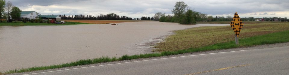
The Lower Thames Valley Conservation Authority provides flood advisories and warnings to municipalities and individuals in flood prone areas. The reaction of streams to a climatic event and the impact on flood prone areas is determined by monitoring weather conditions and the stream gauging network on the Thames River and Indian/McGregor Creek. The LTVCA provides a coordinated response to flooding in the lower Thames region. We use a flood contingency plan and have the expertise and understanding of the geography and river dynamics. We monitor and evaluate weather conditions and river flows on ice jams. The LTVCA is in communication with the Upper Thames River Conservation Authority and the Surface Water Monitoring Centre of Ontario Ministry of Natural Resources.

The Lower Thames Valley and Upper Thames River Conservation Authorities monitor several stream flow and meteorological stations throughout the watershed as part of their Flood Control Program. These stations measure parameters such as water level, rainfall and air temperature in real-time, recording values on at least an hourly basis. This information is collected from remote sites via telephone modem on a daily basis during low flow periods and more frequently during floods, and then stored.

Water levels are converted to flows, which are measured in cubic metres/second (CMS).

  • 1 cubic metre (1,000 litres) = 2 bathtubs
  • 100 cubic metres = an in-ground swimming pool

In the Lower Thames Valley Conservation Authority, we measure stream flow at 4 locations, water elevations at an additional 2 sites, and rainfall at all 6 locations. Other meteorological parameters, such as air and water temperature are also measured in Chatham.

The information provided by the monitoring system supports the LTVCA’s flood management and low flow response activities. In recent years, recreational users of the river have also shown an interest in this information.

As flood control is a provincial responsibility, delegated to Conservation Authorities where they exist, much of the funding for this system comes from the Ontario Ministry of Natural Resources. Many of the stream flow stations are operated by the Water Survey Division of Environment Canada. Stream gauge stations are cooperatively managed through a cost-share agreement between the Province of Ontario and the Federal Government, in partnership with the Conservation Authority.

Water Management

  • Flood Forecasting and Warning
  • LTVCA’s Flood Control Program
  • Water Control Structures
  • The History of Flooding
  • Flood Notices
  • Flood Notice Types
  • Water Levels

Flood Notice Archives

Downloads

  • Personal Flood Emergency Plans
  • Conservation Services Fee Schedule
  • Sandbag Wall Construction Info Sheet

Facebook

What’s New?

  • Breakfast & BMPs – Register Today!
  • NEW! Funding for Farmers – 2025 Guide and Application Form
  • Create Something this March Break
  • Battle of Longwoods Returns to Longwoods Road Conservation Area
  • Birding at Big ‘O’

Partner Links

  • Lower Thames Valley Conservation Foundation
  • Conservation Ontario
  • Thames Heritage River; Canadian Heritage Rivers System
  • Chatham-Kent and Lambton Children’s Water Festival
  • Thames-Sydenham & Region Source Protection Area
  • Thames River Clear Water Revival

Connect with us!

Search

© 2025 · Lower Thames Valley Conservation Authority |[email protected] | Tel: 519-354-7310

  • Home
  • Privacy
  • Public Social Media Policy
  • Contact Form