Highlights:
• Current water levels are down from where they were at this time of the year in 2020, 2019 or even 2018, but are still well above average.
• There is a risk of flooding and shoreline damage along the shorelines of Lake Erie and Lake St. Clair
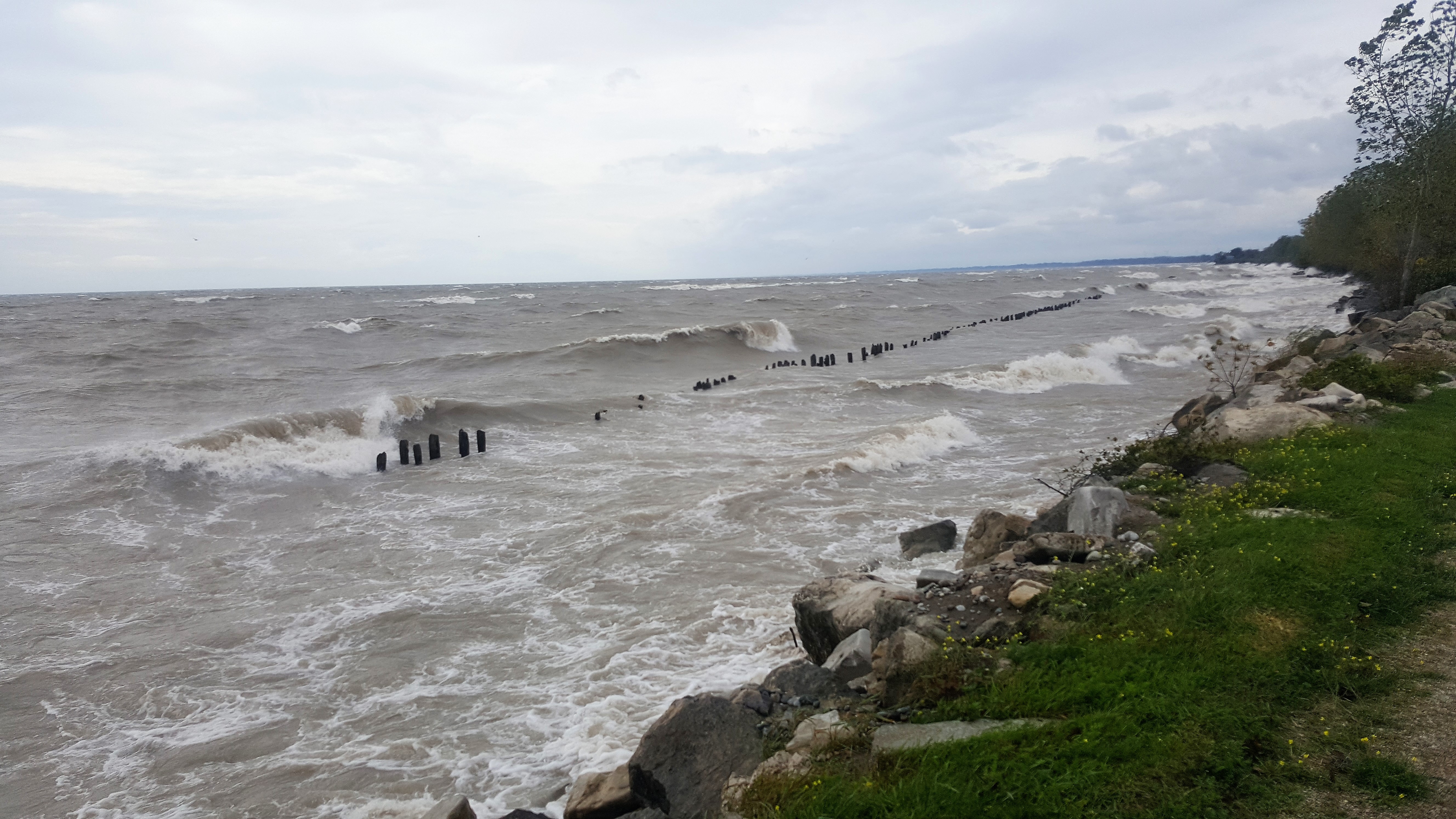
• Sustained wind speeds above moderate can create waves that cause flooding, erosion, and shoreline damage.
• Risk of erosion and damage to shoreline protection works, including erosion along the high bluffs.
Message:
Average daily water levels on Lake Erie at the beginning of June were around 174.69 m (I.G.L.D.). This is down about 45 cm from last year’s peak daily average water level record set at the end of May. The all-time record high monthly average for June was 175.14 m, set in 2019. Water levels at the beginning of June were still 36 cm above what would be considered normal for the month of June. Water level forecasts suggest that water level have essentially peaked for the year and will either remain flat or begin their seasonal decline in June, dropping perhaps 2 to 3 cm by the beginning of July.
Average daily water levels on Lake St. Clair at the beginning of June were around 175.60 m (I.G.L.D.). This is down about 48 cm from last year’s peak daily average water level record set during the third week of May. The all-time record high monthly average for June was 176.02, set last year. Water levels at the beginning of June were 40 cm above what would be considered normal for the month of June. Water level forecasts suggest that water level have essentially peaked for the year, will remain flat through June, and will begin their seasonal decline in July.
Current water levels on the lakes are still well above average. While water levels are down quite a bit from where they were this time of year in 2020, 2019 or even 2018, water levels are fairly similar or slightly below where they were around this time of the year in 2017. Given that the significant flooding issues on Lake Erie and Lake St. Clair began around 2017, flooding remains a concern.
Strong winds out of any direction could have an impact on some areas along our local shorelines. In the most vulnerable areas, such as Erie Shore Drive in Chatham-Kent, wave spray related flooding can begin at sustained wind speeds as low as 30 km/hr, while other less vulnerable areas may need wind speeds closer to 45 km/hr. Gale force winds of 60 km/hr could be expected to cause significant flooding and shoreline damage to any low-lying shoreline area. The area’s most frequently impacted communities and the relevant wind direction include: Lighthouse Cove when winds are out of a north through west direction; Erie Shore Drive when winds are out of the south (SW through SE); the bay side of Erieau when winds are out of a north through east direction; Shrewsbury when winds are out of the east (NNE through ESE); and Rose Beach Line when winds are out of a south through northeast direction. Of course, other shoreline areas are also susceptible.
Erosion and shoreline damage are still concerns as well. The same waves that cause wave spray flooding can damage shoreline protection works and cause erosion in unprotected areas. The bluff areas all along the Lake Erie shoreline are also at a greater risk of erosion due to the high lake levels, especially when there are onshore winds and waves. Along the bluffs, the erosion can cause the bluffs to fail and there have been times over the last few years when many metres of land have fallen into the lake all at one time. Such failures do not necessarily happen during a high wind and wave event, and exactly when the bluff may fail is not something that can be predicted.
Weather systems associated with sudden strong winds, like pressure systems or frontal systems, can also create sudden lake setup effects and cause flooding. Summer thunderstorms are often associated with these systems. This effect has caused flooding with the high lake levels over the last couple of years. Predicting when such flooding may occur is extremely difficult. The Lighthouse Cove area appears to be the community in the LTVCA most affected by this.
Heavy rains could also cause flooding in low-lying shoreline areas. Due to the high lake levels, the groundwater table is high and storm water sewer systems and local watercourses are full with lake water. As a result, rainwater is not draining properly from these areas. Any water from upstream making its way downstream on local watercourses into these shoreline areas could cause additional flooding.
Shoreline residents need to pay attention to local conditions and prepare accordingly. The low wind speeds that lead to wave-related flooding in some areas is very difficult to forecast. As we move into summer, forecasting shoreline flooding becomes even more challenging. Conditions over the lakes can change quickly and with little warning.
Please contact your local municipality should flooding and/or erosion events occur, or should events occur that could impact roadways and other public infrastructure. If there is an urgent risk to personal safety, call 911.
Most importantly, people need to keep themselves safe. Should an event occur, people should be extra careful and avoid the shoreline and any waterways with high water levels. The waves on the lakes can be strong, and the shoreline and the banks of waterways can be slippery and unstable. There could also be hazardous debris within the waves and water which could be thrown onto the shoreline. Standing water can also present unseen hazards. Children and animals should be kept away from the water.
This is a standing message issued for the month of June. Should weather forecasts suggest a sustained wind event likely to cause shoreline issues, this message will be upgraded.
Message Contact: Jason Wintermute ([email protected])