• About Us
    • Vision / Mission Statement
    • About the LTVCA
    • Budget and Financial Statements
    • Board Meeting Packages and Minutes
    • Employment
    • Public Events have been cancelled due to COVID-19 Pandemic
    • FAQ’s
    • Volunteers
    • Fees & Publications
    • What’s New?
    • Public Social Media Policy
  • Planning & Regs
    • Plan Input and Review
    • Regulations
  • Water Management
    • Flood Forecasting and Warning
    • LTVCA’s Flood Control Program
    • Water Control Structures
    • The History of Flooding
    • Flood Notices
    • Flood Notice Types
    • Water Levels
  • Education Programs
    • Education Field Trip Programs
    • Non-School Group Programs
  • Conservation Areas
    • 2021 Parking Pass
    • Conservation Area Day Use & Camping Fees
    • Camping
    • Longwoods Road Conservation Area / Ska-Nah-Doht Village & Museum
      • Trail Features and Challenges
    • Big Bend Conservation Area
    • C.M. Wilson Conservation Area
    • E.M. Warwick Conservation Area
    • All Conservation Areas
  • Conservation Services
    • Tree Planting
    • Grants for Landowners
    • Feature Partnerships & Restoration Projects
    • Soil Health
    • Pollinator Habitats
    • Species at Risk
    • Invasive Species
    • McGregor and Jeannettes Creek Phosphorus Reduction Program
  • Foundation
    • About the LTVC Foundation
    • Carey Carolinian Arboretum and Trail
    • Lower Thames Valley Conservation Foundation Bursary
    • Save the Cabins
    • Memorial Forest Program
    • Fund-Raiser
    • Donate to Conservation
    • Volunteer Directors and Members
    • Ontario Trillium Foundation Capital Grant for Wheelchair Accessible Boardwalk Replacement at Longwoods Road CA
    • Trillium ‘Seed’ Grant – Longwoods Feasibility Study 2018-2019
    • Conservation Foundation Privacy Policy
  • Camping
  • Contact Us
  • 2021 LTVCA Parking Passes
30
Apr

New Lower Thames Valley Watershed Report Cards Reveal Stressed Conditions in Our Watershed

New Lower Thames Valley Watershed Report Cards Reveal Stressed Conditions in Our Watershed

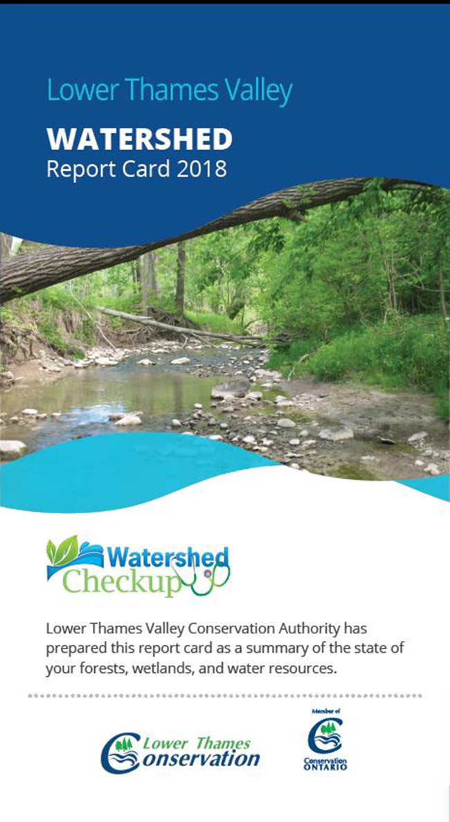
Chatham – A second set of Lower Thames Valley watershed report cards has been rolled out and the grades indicate our watershed is stressed as are the many of Ontario’s watersheds – particularly those in southern, more urban areas.

Conservation Authority watershed report cards show an average grade of ‘C’ for surface water quality and ‘C’ for forest conditions. Groundwater appears to be in better shape, however it is much more difficult to assess on a watershed-wide basis.

The first set of watershed report cards was released in 2013 and showed similar results. The main challenges to healthy watersheds continue to be the impacts of urbanization and climate change.

These watershed report cards bring attention to how important it is to protect our lakes, rivers, streams and groundwater. We rely on them as sources for drinking water, in addition to all kinds of other uses.

“The Conservation Authority Watershed Report Cards provide science-based information to government and agency partners. They are also a good way to get information out to local residents who are very curious about conditions in their areas,” says Kim Gavine – General Manager of Conservation Ontario. “Conservation Authorities also provide information on lots of opportunities for people to get involved and take action.”

“The Lower Thames Valley Conservation Authority Report Card has  grades that  indicate that our watersheds are stressed.  This may be concerning,  however many residents and landowners are doing work to improve our watershed and help us change these grades.   For more information on opportunities to get involved and take action contact the Lower Thames Valley Conservation Authority,” says Mark Peacock, General Manager / Secretary-Treasurer of the Lower Thames Valley Conservation Authority.

Using a variety of methods, including provincial monitoring networks, Conservation Authorities typically monitor and report on three resource categories: surface water quality, forest conditions and groundwater quality. Some Conservation Authorities have also provided information on the state of wetlands in their watersheds.

Conservation Authorities work in many local, provincial and federal partnerships with governments, other agencies, landowners and residents to plan and deliver watershed management programs that strive to keep Ontario’s watersheds healthy. The watershed report cards can be used to target specific actions to address issues and improve conditions.

You can access the Lower Thames Valley watershed report card at www.ltvca.ca and find more information about Ontario’s watershed report cards at www.watershedcheckup.ca .  As well, a story map has been developed to show more detailed information about conditions across the province: www.stateofontariowatersheds.ca

-30-


For more Information;

Jason Wintermute – Water Management Supervisor – Jason.Wintermute@ltvca.ca

Lower Thames Valley Conservation Authority

519-354-7310 ext.227


Kim Gavine, General Manager, Conservation Ontario  kgavine@conservationontario.ca

905.895.0716 ext 231

Jane Lewington, Marketing & Communications Specialist  jlewington@conservationontario.ca

905.895.0716. ext 222


Conservation Ontario represents Ontario’s 36 Conservation Authorities.


-30-

0
SHARES
ShareTweet

Font Size

Zoom in Regular Zoom out

Conservation Services

  • Tree Planting
  • Grants for Landowners
  • Feature Partnerships & Restoration Projects
  • Soil Health
  • Species at Risk
  • Invasive Species
  • Pollinator Habitats
  • McGregor and Jeannettes Creek Phosphorus Reduction Program

LTVCA Program Forms

  • Agricultural Improvement Fund Application Form
  • Tree Species Price List
  • MJCPRP Application Form
  • MJCPRP Claim Form
  • MJCPRP Pamphlet

Recent Posts

  • Breaking Ground – 16 acres of Land Restoration is underway
  • Flood Warning – Erie Shore Drive – January 13, 2021 – 10:15 AM
  • Flood Watch – Lake Erie shoreline, Erie Shore Dr. – January 12, 2021 – 12:30 PM
  • Shoreline Condition Statement – Flood Outlook – Lake Erie Shoreline, Erie Shore Dr. – January 11, 2021 – 10:30 AM

Upcoming Events

  • No events

Partner Links

  • Conservation Ontario
  • Thames-Sydenham & Region Source Protection Area
  • Thames River Clear Water Revival

Search


Chatham-Kent and Lambton Children's Water Festival


Canadian Heritage Rivers


A member of
Conservation Ontario

Copyright 2020 · Lower Thames Valley Conservation Authority
  • /Home
  • /Site Map
  • /Contact Us