• About Us
    • Vision / Mission Statement
    • About the LTVCA
    • Budget and Financial Statements
    • Board Meeting Packages and Minutes
    • Employment
    • Public Events have been cancelled due to COVID-19 Pandemic
    • FAQ’s
    • Volunteers
    • Fees & Publications
    • What’s New?
    • Public Social Media Policy
  • Planning & Regs
    • Plan Input and Review
    • Regulations
  • Water Management
    • Flood Forecasting and Warning
    • LTVCA’s Flood Control Program
    • Water Control Structures
    • The History of Flooding
    • Flood Notices
    • Flood Notice Types
    • Water Levels
  • Education Programs
    • Education Field Trip Programs
    • Non-School Group Programs
  • Conservation Areas
    • 2021 Parking Pass
    • Conservation Area Day Use & Camping Fees
    • Camping
    • Longwoods Road Conservation Area / Ska-Nah-Doht Village & Museum
      • Trail Features and Challenges
    • Big Bend Conservation Area
    • C.M. Wilson Conservation Area
    • E.M. Warwick Conservation Area
    • All Conservation Areas
  • Conservation Services
    • Tree Planting
    • Grants for Landowners
    • Feature Partnerships & Restoration Projects
    • Soil Health
    • Pollinator Habitats
    • Species at Risk
    • Invasive Species
    • McGregor and Jeannettes Creek Phosphorus Reduction Program
  • Foundation
    • About the LTVC Foundation
    • Carey Carolinian Arboretum and Trail
    • Lower Thames Valley Conservation Foundation Bursary
    • Save the Cabins
    • Memorial Forest Program
    • Fund-Raiser
    • Donate to Conservation
    • Volunteer Directors and Members
    • Ontario Trillium Foundation Capital Grant for Wheelchair Accessible Boardwalk Replacement at Longwoods Road CA
    • Trillium ‘Seed’ Grant – Longwoods Feasibility Study 2018-2019
    • Conservation Foundation Privacy Policy
  • Camping
  • Contact Us
  • 2021 LTVCA Parking Passes
25
Nov

LTVCA – Lake Erie Shoreline and Erie Shore Drive – Watershed Conditions – Safety Bulletin – November 25, 2018 – 12:45 p.m.

LTVCA – Lake Erie Shoreline and Erie Shore Drive – Watershed Conditions – Safety Bulletin – November 25, 2018 – 12:45 p.m.

Highlights:

  • Strong winds overnight Sunday through Wednesday morning
  • Uncertainty in actual wind directions
  • Potential for erosion, shoreline damage, flooding, and freezing spray.


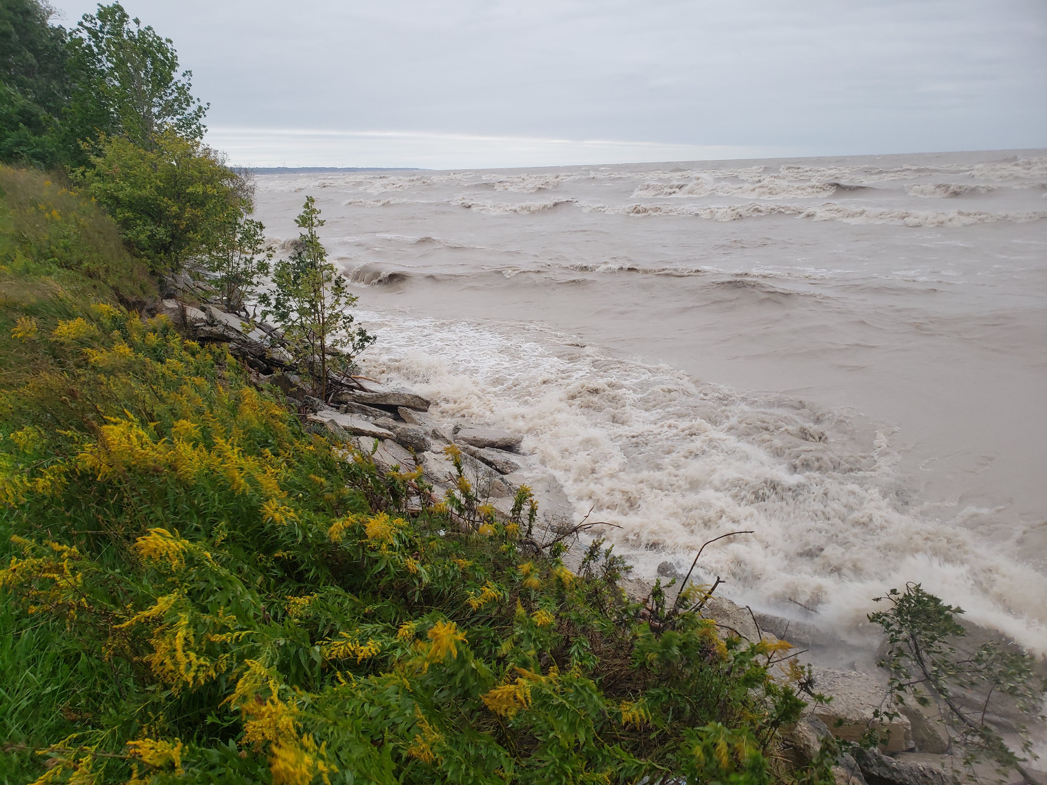
Environment Canada’s Marine Forecast has issued a Strong Wind Warning for Western Lake Erie.  Weather forecasts are calling for winds exceeding 35 km/hr overnight tonight through Wednesday morning. Overnight tonight, winds are expected to be from the east or northeast. Tuesday and Wednesday, winds are expected to be from the west. But the various forecasts do not agree on whether winds on Monday will be transitioning through the north or through the south, in order to arrive in that westerly direction on Tuesday. However, the forecasts are generally in agreement that the winds will remain strong throughout this period. Waves on Lake Erie are forecasted to reach 1.5 to 2 m in height.

While winds are out of the northeast, there is the potential for shoreline impacts to the eastern side of Rondeau, including the Rose Beach Line area. There is a risk of erosion, damage to shoreline protection, and backup flooding from the various drain outlets in that stretch. Should the winds transition to the south, winds will be driving waves onto the whole length of our Lake Erie shoreline in Chatham-Kent and Elgin Counties. There is a risk that wave action could damage shoreline protection works, cause shoreline erosion, create flooding due to wave crashing against shoreline protection works along Erie Shore Drive, or create backup flooding from the various drain outlets in the Lake Erie shoreline stretch as well. Temperatures are predicted to be below freezing Monday night through Wednesday, and during this period there is a risk that wave spray or floodwaters could freeze creating hazardous conditions. Given the uncertainty around these forecasts, residents along the Lake Erie shoreline should pay close attention to both weather forecasts and current conditions and prepare accordingly.

People should take extra caution and avoid the shoreline should conditions get rough.  The waves can be strong and the shoreline slippery.  There could also be hazardous debris within the waves and water which could be thrown onto the shoreline.  Standing water can also present unseen hazards.  Children and pets should be kept away from the water.  Officials will continue to monitor the situation and update this advisory if necessary.

Contact:  Jason Wintermute (Jason.Wintermute@ltvca.ca, 519-354-7310 x227) regarding this message.

This message will be in effect until November 29, 2018.

0
SHARES
ShareTweet

Font Size

Zoom in Regular Zoom out

Water Management

  • Flood Forecasting and Warning
  • LTVCA’s Flood Control Program
  • Water Control Structures
  • The History of Flooding
  • Flood Notices
  • Flood Notice Types
  • Water Levels
  • Harmful Algae Blooms

Flood Notice Archives

Downloads

  • Fee Schedule – Conservation Services
  • Personal Flood Emergency Plans

Recent Posts

  • Flood Watch – Lake Erie shoreline, Erie Shore Dr. – January 20, 2021 – 11:30 AM
  • Breaking Ground – 16 acres of Land Restoration is underway
  • Flood Warning – Erie Shore Drive – January 13, 2021 – 10:15 AM
  • Flood Watch – Lake Erie shoreline, Erie Shore Dr. – January 12, 2021 – 12:30 PM

Upcoming Events

  • No events

Partner Links

  • Conservation Ontario
  • Thames-Sydenham & Region Source Protection Area
  • Thames River Clear Water Revival

Search


Chatham-Kent and Lambton Children's Water Festival


Canadian Heritage Rivers


A member of
Conservation Ontario

Copyright 2020 · Lower Thames Valley Conservation Authority
  • /Home
  • /Site Map
  • /Contact Us