Highlights:
• Risk of shoreline erosion and damage to shoreline protection along the north shore of Lake Erie overnight into Saturday morning as well as early Sunday morning.
• Risk of flooding on Erie Shore Drive overnight into Saturday morning and again early Sunday morning.
• Rain in the forecast could aggravate flooding in low-lying shoreline communities such as Shrewsbury near the outlet of watercourses and municipal drains.
Message:
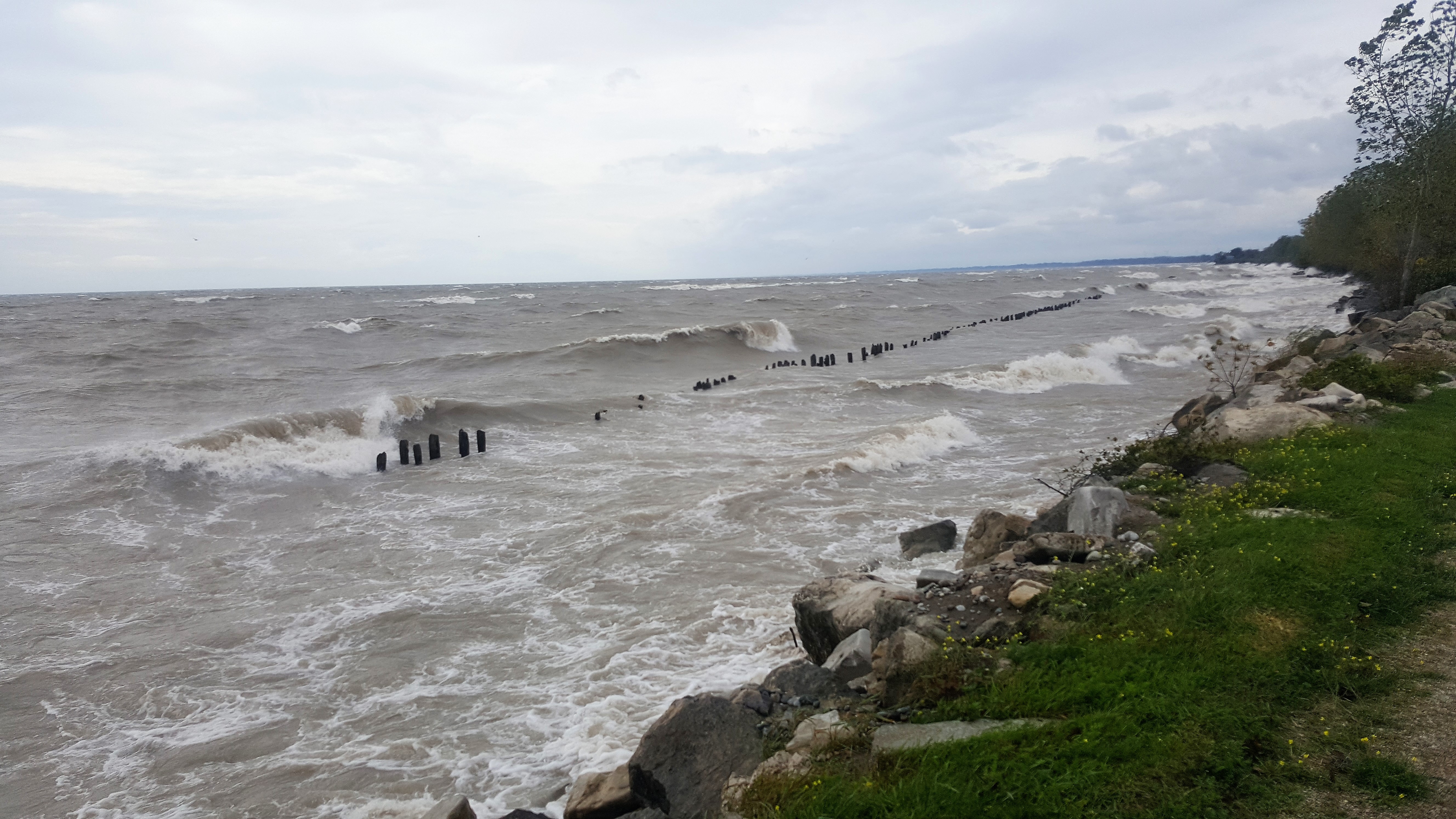
Strong winds exceeding 35 km/hour out of the south are currently forecasted for early Saturday starting at around midnight and persisting through to early Saturday morning. Sustained winds out of the south are currently forecasted to peak at 45 km/hour with gusts up to 70 km/hour prior to dawn. Wave forecasts are generally calling for waves on Lake Erie to be around one metre in height early Saturday morning. On Sunday prior to dawn, sustained winds out of the southeast, south, and southwest are currently forecasted to peak at 55 km/hour with gusts up to 85 km/hour.
There is a risk that wave action could damage shoreline protection works and cause erosion all along the Lake Erie shoreline in Chatham-Kent and Elgin County, including along the high bluff areas. Flooding could also occur in low-lying, south facing shoreline areas such as along Erie Shore Drive in Chatham-Kent. The current forecast is calling for the wind to be out of the south for most of the night into Saturday morning. On Sunday, there will be a period of time where the winds switch from the southeast to the southwest where Erie Shore Drive will see flooding. At this point, that period of time is only forecasted to be a couple of hours. Generally, the worst flooding on Erie Shore Drive is when the winds are directly out of the south. The prolonged period of high winds out of the south could also have a greater impact than expected. Residents should pay attention to local conditions and be prepared.
The public should take extra caution and avoid the shoreline should conditions get rough. The waves can be strong and the shoreline slippery. There could also be hazardous debris within the waves and water which could be thrown onto the shore. Standing water can also present unseen hazards. Children and animals should be kept away from the water.
The rain in the forecast for Friday night and Saturday could aggravate the flooding situation along the shoreline. The water level (and groundwater table) is so high in shoreline areas that the rain will have problems draining away and may lead to localized flooding. In addition, those watercourses that drain into the lakes are already very high in their downstream ends due to high lake levels. The additional rain has the potential to cause excess flooding from these watercourses. Shrewsbury would be a community particularly at risk from this, although other areas could be impacted too.
The public should take extra caution and avoid the river, ditches, and streams. The combination of slippery banks and fast moving cold water can be dangerous. Standing water can also present unseen hazards. Children and animals should be kept away from the water.
Officials will continue to monitor the situation and update this advisory if necessary.
This message will be in effect until 13 January 2020.