Highlights:
• Current water levels on the lakes exceed their record high April and May monthly averages.
• Moderate to strong sustained winds and/or heavy rains could cause flooding, erosion and shoreline damage
• Risk of shoreline flooding on both lakes
• Risk of erosion and damage to shoreline protection works on both lakes
Message:
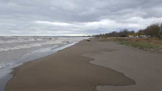
Current average daily water levels on Lake Erie sit at around 175.06 m (I.G.L.D.) This water level exceeds the record high monthly average water levels for both April (set back in 1985) and May (set last year). Current water levels are similar to those observed throughout the month of May last year, and similar to water levels observed at the beginning of August last year. Daily average water levels on Lake Erie peaked last year on June 22nd at an elevation of 175.19 m (I.G.L.D.). Long range water levels forecasts should be coming at the beginning of next week. Long range precipitation forecasts are calling for normal to slightly above normal amounts of precipitation over the next three months. Based on current information, peak water levels this summer should be expected to be similar to those last year.
Current average daily water levels on Lake St. Clair sit at around 175.96 m (I.G.L.D.) This water level exceeds the record high monthly average water levels for both April (set back in 1986) and May (set last year). Current water levels are similar to those observed in mid-June of last year, and similar to water levels observed throughout the month of August last year. Daily average water levels on Lake St. Clair peaked last year on July 7/8th at an elevation of 176.08 m (I.G.L.D.). Long range water levels forecasts should be coming at the beginning of next week. Long range precipitation forecasts are calling for normal to slightly above normal amounts of precipitation over the next three months. Based on current information, peak water levels this summer should be expected to be similar to those last year.
As can be seen by the water elevations referenced above, current water levels on the lakes are very close to the peak water levels observed last year. The difference between current water levels and peak water levels last year are not significant. Sustained winds can cause an effect known as setup where water from one end of the lake gets pushed to the other, creating a rise in water levels at the far end of the lake. In the LTVCA jurisdiction, on both lakes, the water level rise from this effect can exceed the current difference between current lake levels and last year’s peak water levels. In addition, wave heights on the lakes can far exceed this difference. The current risks of flooding and shoreline damage are essentially the same as they were last year during the peak water level summer months. The extent of any flooding and shoreline damage we may experience will be determined by the wind speed, wind direction and the waves they create.
Strong sustained winds can lead to water level changes and waves that cause shoreline issues. Strong winds out of any direction could have an impact on some area along our local shorelines. In the most vulnerable areas such as Erie Shore Drive in Chatham-Kent wave spray related flooding can occur at wind speeds as low as 25 km/hr, while other less vulnerable areas may need wind speeds closer to 45 km/hr. Gale force winds of 60 km/hr could be expected to cause significant flooding and shoreline damage to any low lying shoreline area. The areas most frequently impacted and the relevant wind direction include: Lighthouse Cove when winds are out of a north through west direction; Erie Shore Drive when winds are out of the south (SW through SE); the bay side of Erieau when winds are out of a north through east direction; Shrewsbury when winds are out of the east (NNE through ESE); and Rose Beach Line when winds are out of a south through northeast direction. Of course, other shoreline areas are also susceptible. The bluff areas all along the Lake Erie shoreline are also at a greater risk of erosion due to the high lake levels, especially when there are onshore winds and waves. Along the bluffs, the erosion can cause the bluffs to fail and there have been instances of land many metres deep falling into the lake all at one time.
Heavy rains could also cause flooding in low lying shoreline areas. Due to the high lake levels, the groundwater table is high and storm water sewer systems and local watercourses are full with lake water. As a result, rainwater is not draining properly from these areas. Any water from upstream making its way downstream on these watercourses into these shoreline areas could cause additional flooding.
Shoreline residents need to pay attention to local conditions and prepare accordingly. The low wind speed thresholds that lead to wave related flooding in some areas is very difficult to forecast. Wind conditions over the lakes can change quickly and with little warning.
Please contact your local municipality should significant flooding and/or erosion events occur, or should events occur that may impact roadways and other public infrastructure. If there is an imminent risk to personal safety, call 911.
Most importantly, people need to keep themselves safe. Should an event occur, people should take extra caution and avoid the shoreline and any waterways with elevated water levels. The waves on the lakes can be strong, and the shoreline and the banks of waterways can be slippery and unstable. There could also be hazardous debris within the waves and water which could be thrown onto the shoreline. Standing water can also present unseen hazards. Children and animals should be kept away from the water.
This is a standing message issued for the month of April. Should weather forecasts suggest a sustained wind event likely to cause shoreline issues, this message will be upgraded.
Message Contact: Jason Wintermute ([email protected])