• About Us
    • Vision / Mission Statement
    • About the LTVCA
    • Budget and Financial Statements
    • Board Meeting Packages and Minutes
    • Employment
    • Public Events have been cancelled due to COVID-19 Pandemic
    • FAQ’s
    • Volunteers
    • Fees & Publications
    • What’s New?
    • Public Social Media Policy
  • Planning & Regs
    • Plan Input and Review
    • Regulations
  • Water Management
    • Flood Forecasting and Warning
    • LTVCA’s Flood Control Program
    • Water Control Structures
    • The History of Flooding
    • Flood Notices
    • Flood Notice Types
    • Water Levels
  • Education Programs
    • Education Field Trip Programs
    • Non-School Group Programs
  • Conservation Areas
    • 2021 Parking Pass
    • Conservation Area Day Use & Camping Fees
    • Camping
    • Longwoods Road Conservation Area / Ska-Nah-Doht Village & Museum
      • Trail Features and Challenges
    • Big Bend Conservation Area
    • C.M. Wilson Conservation Area
    • E.M. Warwick Conservation Area
    • All Conservation Areas
  • Conservation Services
    • Tree Planting
    • Grants for Landowners
    • Feature Partnerships & Restoration Projects
    • Soil Health
    • Pollinator Habitats
    • Species at Risk
    • Invasive Species
    • McGregor and Jeannettes Creek Phosphorus Reduction Program
  • Foundation
    • About the LTVC Foundation
    • Carey Carolinian Arboretum and Trail
    • Lower Thames Valley Conservation Foundation Bursary
    • Save the Cabins
    • Memorial Forest Program
    • Fund-Raiser
    • Donate to Conservation
    • Volunteer Directors and Members
    • Ontario Trillium Foundation Capital Grant for Wheelchair Accessible Boardwalk Replacement at Longwoods Road CA
    • Trillium ‘Seed’ Grant – Longwoods Feasibility Study 2018-2019
    • Conservation Foundation Privacy Policy
  • Camping
  • Contact Us
  • 2021 LTVCA Parking Passes
14
Jan

Watershed Conditions – Flood Outlook – Lake Erie Shoreline and Erie Shore Drive – January 14, 2019 – 4:30 p.m.

Watershed Conditions – Flood Outlook – Lake Erie Shoreline and Erie Shore Drive – January 14, 2019 – 4:30 p.m.

Highlights:

  • Strong southwest winds and waves tomorrow afternoon through the overnight period
  • Peak winds and waves are expected in the late evening to early overnight period
  • Risk of flooding along Erie Shore Dr. and damage all along the shore in Chatham-Kent & Elgin County
  • Freezing temperatures could cause hazardous, icy conditions

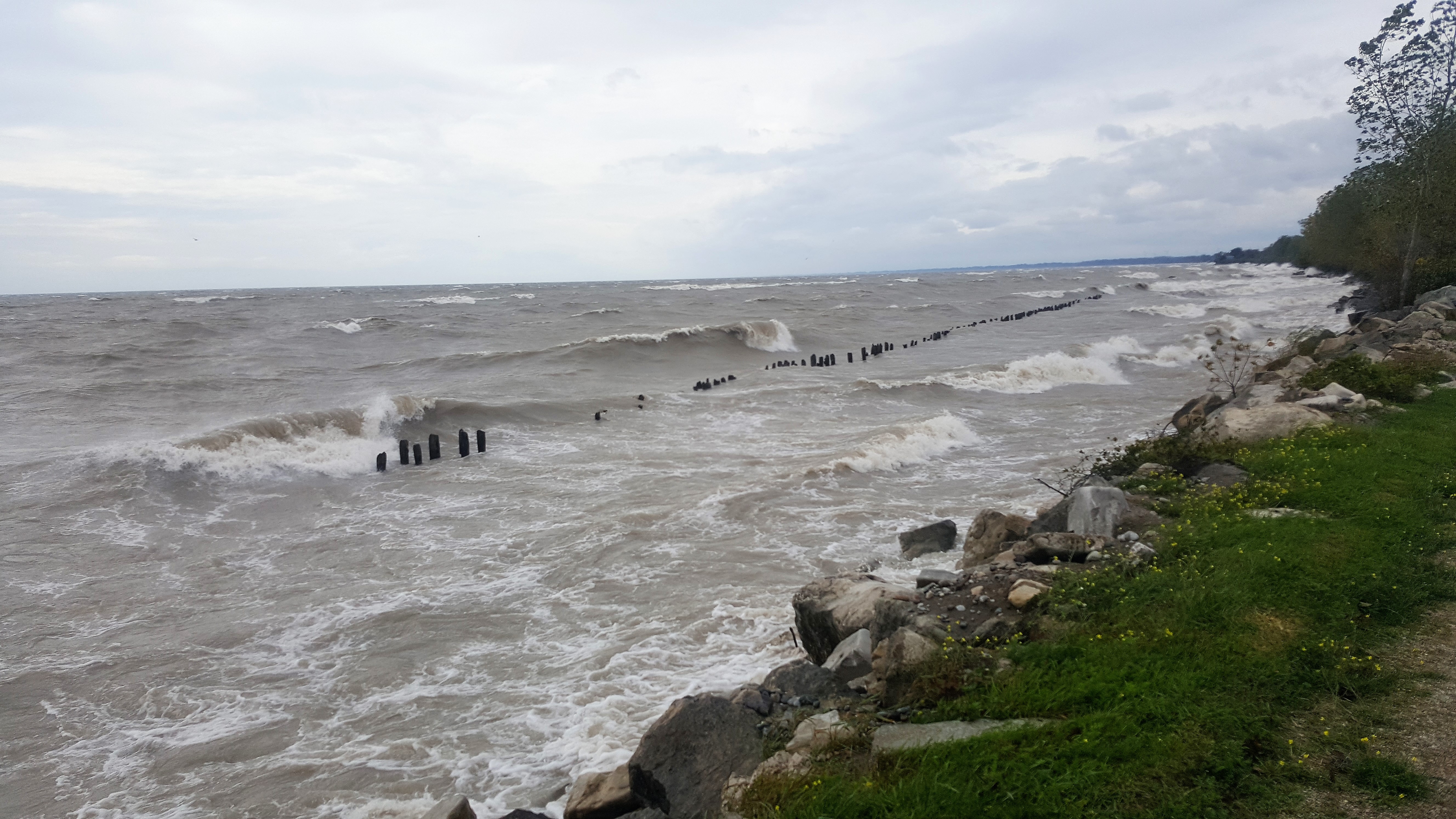
Weather forecasts are calling for strong sustained winds from the southwest tomorrow afternoon, lasting through the overnight period. During this time, sustained wind speeds above 30 km/hr can be expected. Forecasts suggest wind speeds could peak at around 45 km/hr in the late evening tomorrow. Peak wind gusts could reach 65 km/hr. Waves on Lake Erie are predicted to reach 1.5 m in height during this period.

Strong southwest winds will be driving waves onto our Lake Erie shoreline in Chatham-Kent and Elgin County. There is a risk that wave action could damage shoreline protection works and cause shoreline erosion. In flood prone areas such as Erie Shore Drive in Chatham-Kent, flooding caused by waves crashing against the shoreline protection works and spraying water up onto the land is likely to occur if the forecasts hold. In addition, temperatures are expected to remain around the freezing point during this wind event. The wave spray could create hazardous, icy conditions, especially if flood waters reach the roadway. Residents along the Lake Erie shoreline should pay attention to weather forecasts and local conditions and prepare accordingly.

People should take extra caution and avoid the shoreline should conditions get rough. The waves can be strong and the shoreline slippery. There could also be hazardous debris within the waves and water which could be thrown onto the shoreline. The water could also freeze creating hazardous, icy conditions. Standing water can also present unseen hazards. Children and pets should be kept away from the water. Officials will continue to monitor the situation and update this advisory if necessary.

Contact: Jason Wintermute (Jason.Wintermute@ltvca.ca) or Jason Homewood (Jason.Homewood@ltvca.ca) regarding this message.

This message will be in effect until January 16, 2019.


0
SHARES
ShareTweet

Font Size

Zoom in Regular Zoom out

Water Management

  • Flood Forecasting and Warning
  • LTVCA’s Flood Control Program
  • Water Control Structures
  • The History of Flooding
  • Flood Notices
  • Flood Notice Types
  • Water Levels
  • Harmful Algae Blooms

Flood Notice Archives

Downloads

  • Fee Schedule – Conservation Services
  • Personal Flood Emergency Plans

Recent Posts

  • Attention Sharon Creek Conservation Area Visitors!
  • LTVCA PARKING PASS EARTH DAY SPECIAL OFFER!
  • Shoreline Condition Statement – Flood Outlook – Standing Message – Lake Erie & Lake St. Clair – High Static Water Level – April 2021
  • Offices Closed Good Friday, Easter Monday

Upcoming Events

  • No events

Partner Links

  • Conservation Ontario
  • Thames-Sydenham & Region Source Protection Area
  • Thames River Clear Water Revival

Search


Chatham-Kent and Lambton Children's Water Festival


Canadian Heritage Rivers


A member of
Conservation Ontario

Copyright 2020 · Lower Thames Valley Conservation Authority
  • /Home
  • /Site Map
  • /Contact Us