• About Us
    • Vision / Mission Statement
    • About the LTVCA
    • Budget and Financial Statements
    • Board Meeting Packages and Minutes
    • Employment
    • Public Events have been cancelled due to COVID-19 Pandemic
    • FAQ’s
    • Volunteers
    • Fees & Publications
    • What’s New?
    • Public Social Media Policy
  • Planning & Regs
    • Plan Input and Review
    • Regulations
  • Water Management
    • Flood Forecasting and Warning
    • LTVCA’s Flood Control Program
    • Water Control Structures
    • The History of Flooding
    • Flood Notices
    • Flood Notice Types
    • Water Levels
  • Education Programs
    • Education Field Trip Programs
    • Non-School Group Programs
  • Conservation Areas
    • 2021 Parking Pass
    • Conservation Area Day Use & Camping Fees
    • Camping
    • Longwoods Road Conservation Area / Ska-Nah-Doht Village & Museum
      • Trail Features and Challenges
    • Big Bend Conservation Area
    • C.M. Wilson Conservation Area
    • E.M. Warwick Conservation Area
    • All Conservation Areas
  • Conservation Services
    • Tree Planting
    • Grants for Landowners
    • Feature Partnerships & Restoration Projects
    • Soil Health
    • Pollinator Habitats
    • Species at Risk
    • Invasive Species
    • McGregor and Jeannettes Creek Phosphorus Reduction Program
  • Foundation
    • About the LTVC Foundation
    • Carey Carolinian Arboretum and Trail
    • Lower Thames Valley Conservation Foundation Bursary
    • Save the Cabins
    • Memorial Forest Program
    • Fund-Raiser
    • Donate to Conservation
    • Volunteer Directors and Members
    • Ontario Trillium Foundation Capital Grant for Wheelchair Accessible Boardwalk Replacement at Longwoods Road CA
    • Trillium ‘Seed’ Grant – Longwoods Feasibility Study 2018-2019
    • Conservation Foundation Privacy Policy
  • Camping
  • Contact Us
  • 2021 LTVCA Parking Passes
16
Jan

Watershed Conditions – Flood Outlook – January 16th, 2018 – 4:30 PM

Watershed Conditions – Flood Outlook – January 16th, 2018 – 4:30 PM

Last week the Thames River watershed experienced a warm spell and rainfall that melted much of the snow out of the watershed. Temperatures have now fallen below freezing and are expected to remain there until Saturday. Before this warm up, many of the region’s smaller watercourses were filled with snow and ice. The Thames River at Lighthouse Cove had approximately 30 cm of ice cover and subsequent observations suggest there was between 15 and 20 cm of ice cover in areas further upstream.

Water levels had risen on many of the region’s smaller local watercourses and some spilled their banks. In some areas the situation was aggravated by snow and ice blockages in those watercourses. Water levels on these smaller watercourses have returned to normal seasonal levels, except for those which are influenced by the Thames River which is still high.

Water levels on the Thames River are now in decline from the City of London down to Thamesville. Water levels around Thamesville peaked last night and are now declining there as well. Water levels in the City of Chatham are expected to peak overnight or tomorrow morning. It is expected that the water levels in the City of Chatham will rise no more than another 30 cm by the time they peak. Elevated water levels can be expected for several days after the peak passes.

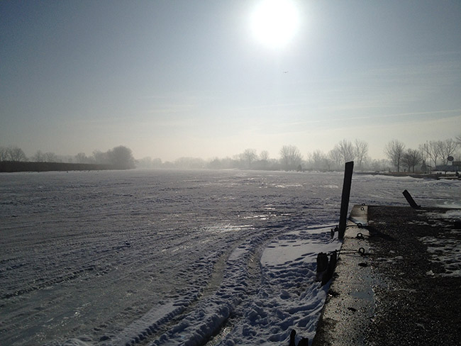
Accumulations of broken up ice can be observed around the Thamesville area from just upstream of Little John Road to a few kilometers downstream of Thamesville. As water levels drop in the area, it is expected that this ice will solidify in place. Broken up ice is also starting to accumulated just before Kent Bridge but the river ice remains largely intact from there through the City of Chatham down to the mouth. Through the City of Chatham large areas of open water have appeared where the ice has melted out.

People should take extra caution and avoid the river, ditches, and streams. The combination of slippery banks, broken or unstable ice and fast moving cold water can be dangerous. Standing water can also present its own unseen hazards. Children and pets should be kept away from the water.

Officials will continue to monitor the situation and update this advisory if necessary.
This message will be in effect until January 20th, 2018.

Contact: Jason Wintermute (jason.wintermute@ltvca.ca) regarding this message.

0
SHARES
ShareTweet

Font Size

Zoom in Regular Zoom out

Water Management

  • Flood Forecasting and Warning
  • LTVCA’s Flood Control Program
  • Water Control Structures
  • The History of Flooding
  • Flood Notices
  • Flood Notice Types
  • Water Levels
  • Harmful Algae Blooms

Flood Notice Archives

Downloads

  • Fee Schedule – Conservation Services
  • Personal Flood Emergency Plans

Recent Posts

  • Breaking Ground – 16 acres of Land Restoration is underway
  • Flood Warning – Erie Shore Drive – January 13, 2021 – 10:15 AM
  • Flood Watch – Lake Erie shoreline, Erie Shore Dr. – January 12, 2021 – 12:30 PM
  • Shoreline Condition Statement – Flood Outlook – Lake Erie Shoreline, Erie Shore Dr. – January 11, 2021 – 10:30 AM

Upcoming Events

  • No events

Partner Links

  • Conservation Ontario
  • Thames-Sydenham & Region Source Protection Area
  • Thames River Clear Water Revival

Search


Chatham-Kent and Lambton Children's Water Festival


Canadian Heritage Rivers


A member of
Conservation Ontario

Copyright 2020 · Lower Thames Valley Conservation Authority
  • /Home
  • /Site Map
  • /Contact Us