• About Us
    • Vision / Mission Statement
    • About the LTVCA
    • Budget and Financial Statements
    • Board Meeting Packages and Minutes
    • Employment
    • Public Events have been cancelled due to COVID-19 Pandemic
    • FAQ’s
    • Volunteers
    • Fees & Publications
    • What’s New?
    • Public Social Media Policy
  • Planning & Regs
    • Plan Input and Review
    • Regulations
  • Water Management
    • Flood Forecasting and Warning
    • LTVCA’s Flood Control Program
    • Water Control Structures
    • The History of Flooding
    • Flood Notices
    • Flood Notice Types
    • Water Levels
  • Education Programs
    • Education Field Trip Programs
    • Non-School Group Programs
  • Conservation Areas
    • 2021 Parking Pass
    • Conservation Area Day Use & Camping Fees
    • Camping
    • Longwoods Road Conservation Area / Ska-Nah-Doht Village & Museum
      • Trail Features and Challenges
    • Big Bend Conservation Area
    • C.M. Wilson Conservation Area
    • E.M. Warwick Conservation Area
    • All Conservation Areas
  • Conservation Services
    • Tree Planting
    • Grants for Landowners
    • Feature Partnerships & Restoration Projects
    • Soil Health
    • Pollinator Habitats
    • Species at Risk
    • Invasive Species
    • McGregor and Jeannettes Creek Phosphorus Reduction Program
  • Foundation
    • About the LTVC Foundation
    • Carey Carolinian Arboretum and Trail
    • Lower Thames Valley Conservation Foundation Bursary
    • Save the Cabins
    • Memorial Forest Program
    • Fund-Raiser
    • Donate to Conservation
    • Volunteer Directors and Members
    • Ontario Trillium Foundation Capital Grant for Wheelchair Accessible Boardwalk Replacement at Longwoods Road CA
    • Trillium ‘Seed’ Grant – Longwoods Feasibility Study 2018-2019
    • Conservation Foundation Privacy Policy
  • Camping
  • Contact Us
  • 2021 LTVCA Parking Passes
9
Feb

Flood Warning – February 9, 2019 – 11:00 a.m.

Flood Warning – February 9, 2019 – 11:00 a.m.

Highlights:

• Ice jam at Lighthouse Cove remains in place.
• Water levels on the Thames River downstream of Chatham are beginning to fall.
• Ice jam related risks continue as the jam could shift as it settles into lower water levels.
• Operations of the 6th St. Dam in Chatham are no longer required.

Message:

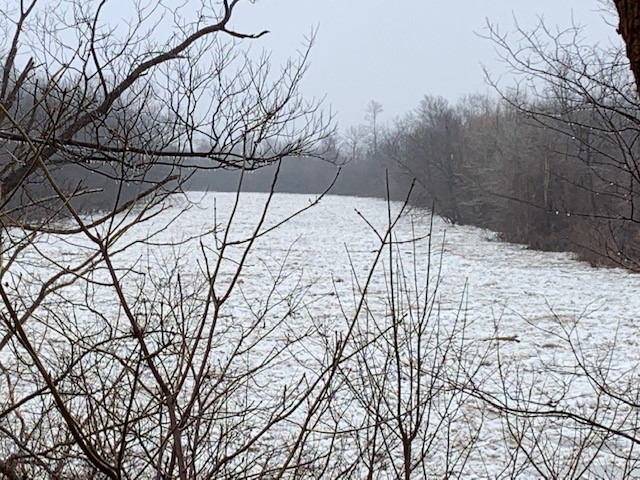
The ice jam that formed Thursday night at Lighthouse Cove remains in place. Over the last few days this has caused higher than expected water levels considering the amount of flow. The 6th St. Dam had to be operated to protect the south end of the city of Chatham from flooding. Flood protection works downstream of the city were at risk of being overtopped or breaching.

Water levels are now falling in the area of the ice jam. Municipal staff and contractors have managed to maintain the flood protection works except in a couple areas and the amount of flooding has been limited. Minor leaks are still being reported in places. Although the risks have greatly lessened with the falling water levels, there remain some risks associated with the ice jam. As water levels drop and the jam settles into the lower water levels, the jam could shift and create surges or severe jamming.

Residents of Lighthouse Cove and other downstream communities should remain prepared. Residents should contact the municipality for the latest information or to report concerns. Chatham-Kent 519-360-1998, Lakeshore 519-728-2488.

In the city of Chatham, water levels have fallen low enough that the operation of the 6th Street Dam is no longer required. Residents upstream on McGregor Creek could see a slight increase in water levels on the creek as water levels equalize with the river.

People should take extra caution and avoid the river, ditches, and streams. The combination of slippery banks, broken or unstable ice and fast moving cold water can be dangerous. Ice jams can be particularly dangerous. Standing water can also present its own unseen hazards. Children and pets and livestock should be kept away from the water and ice.

Officials will continue to monitor the situation and update this advisory if necessary.

This message will be in effect until February 11th, 2019.

Contact: LTVCA Administration Office (519-354-7310) regarding this message.

0
SHARES
ShareTweet

Font Size

Zoom in Regular Zoom out

Water Management

  • Flood Forecasting and Warning
  • LTVCA’s Flood Control Program
  • Water Control Structures
  • The History of Flooding
  • Flood Notices
  • Flood Notice Types
  • Water Levels
  • Harmful Algae Blooms

Flood Notice Archives

Downloads

  • Fee Schedule – Conservation Services
  • Personal Flood Emergency Plans

Recent Posts

  • Breaking Ground – 16 acres of Land Restoration is underway
  • Flood Warning – Erie Shore Drive – January 13, 2021 – 10:15 AM
  • Flood Watch – Lake Erie shoreline, Erie Shore Dr. – January 12, 2021 – 12:30 PM
  • Shoreline Condition Statement – Flood Outlook – Lake Erie Shoreline, Erie Shore Dr. – January 11, 2021 – 10:30 AM

Upcoming Events

  • No events

Partner Links

  • Conservation Ontario
  • Thames-Sydenham & Region Source Protection Area
  • Thames River Clear Water Revival

Search


Chatham-Kent and Lambton Children's Water Festival


Canadian Heritage Rivers


A member of
Conservation Ontario

Copyright 2020 · Lower Thames Valley Conservation Authority
  • /Home
  • /Site Map
  • /Contact Us